Great Walk Series: Routeburn Return Track
I’m on the roll for Great Walks!
This a continuation of my last few posts – all on Great Walks. Some backstory: A few of us have travelled with a vengeance after the lockdown and covered South Island extensively. We splurged on expensive touristy activities – bungy, skydiving – yet tried to save a little money along the way by bunking in friends’ places and doing the walks during their off-season.
Doing Great Walks during the off-season meant cheaper accommodation rates and fewer crowds. Additional perks are the endless snow peaks and beautiful sunrises/ sunsets.
We’ve covered the Abel Tasman Coast Track, the Rakiura Track and the Kepler Track before this.
The Routeburn Track is the fourth consecutive track I did during winter.
Unlike the conventional route, where you start from the Routeburn car park in Glenorchy and end at The Divide, which exits into the highway towards Milford Sound, we start and end at the carpark.
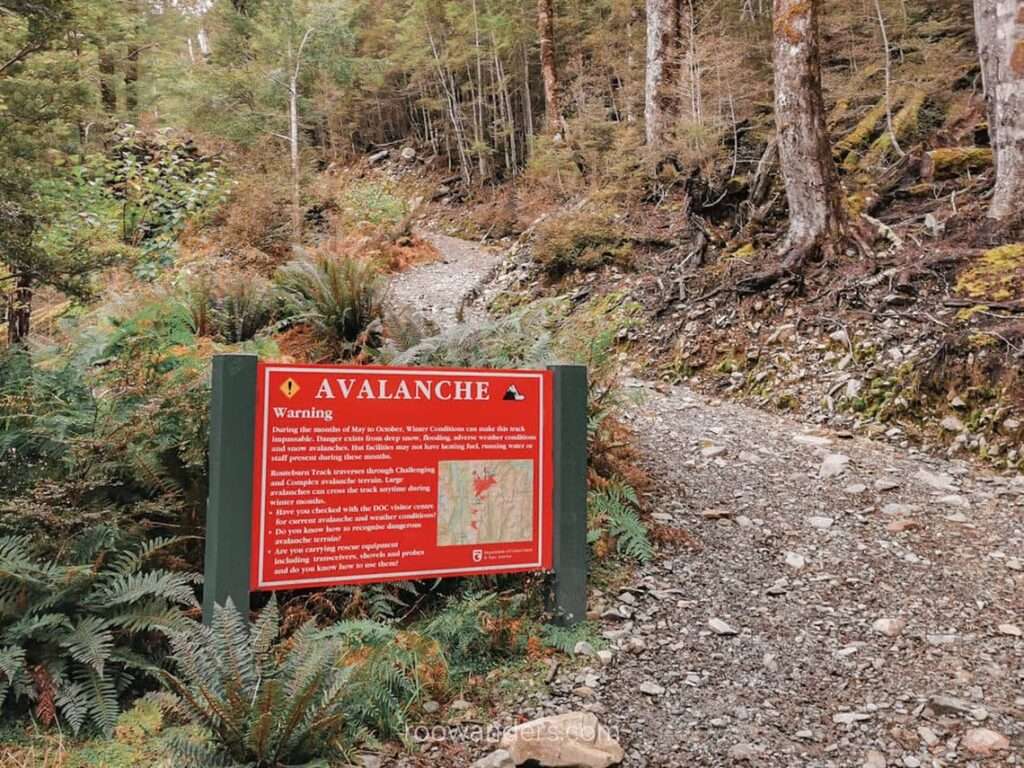
A freak heavy downpour last February (2020) decimated parts of the track beyond Lake Mackenzie Hut and made them unsafe for tramping.
Best Time to Go
I would pick the off-season for the snow-capped peaks and fewer crowds.
But if you are a beginner to alpine tramping or are unsure about your capabilities, choose to walk during the season instead. If cost is your concern, consider tramping just after or before the Great Walk season when the weather is still favourable.
More About the Track
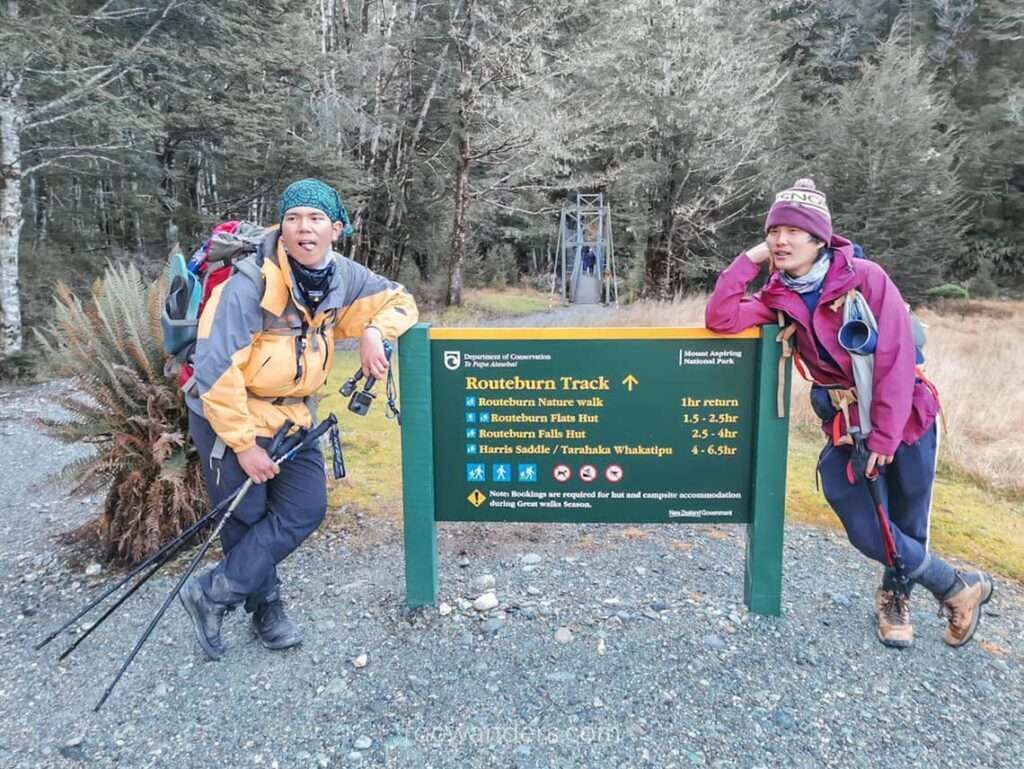
The Routeburn Track is a one-way route about 33 km in length. Not that long when you think about it. Some ran through the track within a day.
This is an alpine tramp where you’ll need to trek over high elevations with the risk of avalanches during winter. Proper equipment and experience are required. People have died on this track, as we saw from the plaque placed somewhere around the Harris Saddle.
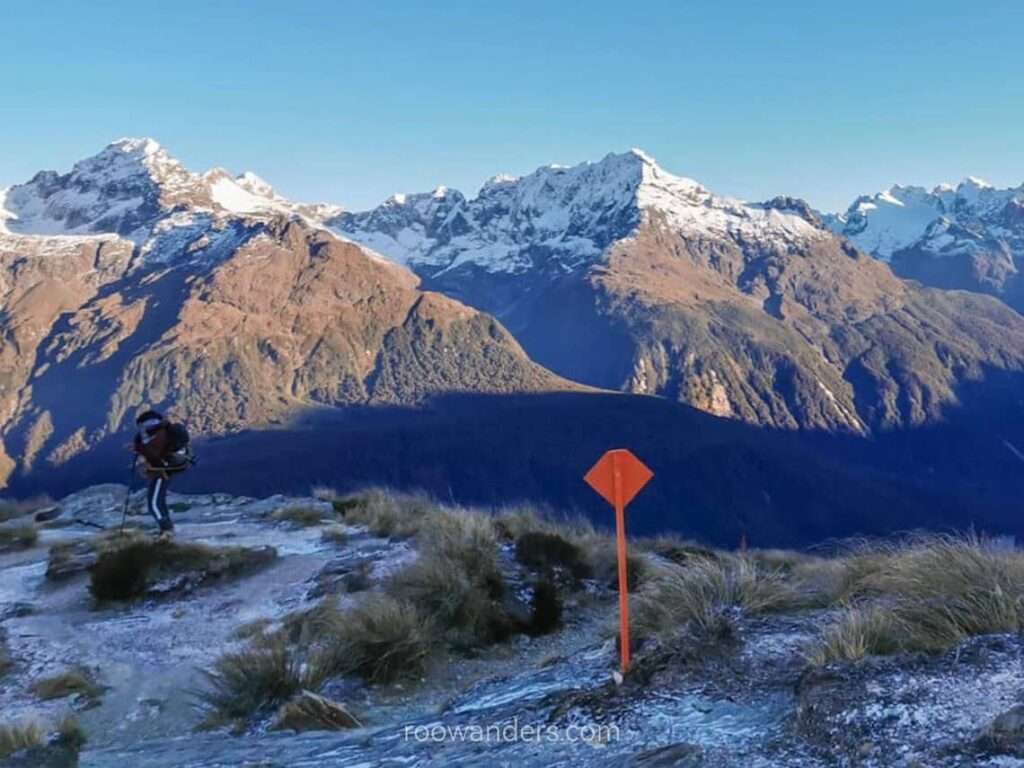
The track’s highest point is at Harris Saddle (1,255 m).
Getting There
There are two ways to enter the track.
Under normal circumstances, you could choose to start from the Routeburn Carpark, about 30 mins drive along an unsealed road from Glenorchy, or the Divide Shelter that’s an hour and a half from Te Anau, along the road to Milford Sound.
I dislike one-way tracks. How do I get to my car at the end of the tramp?
You’ll need to set aside some moolah to relocate your transport. Or arrange for a shuttle. Alternatively, have another group of trekkers start from the opposite end and trade keys along the way. Either way, my pals and I had no other option due to the floods and had to retrace our route back from Mackenzie Hut.
Accommodation
There are two campsites and three huts along the track.
The first site – Routeburn Falls Flat – contains a hut and a campsite, and is suitable for an overnight stay. Maybe throw in a party too.
It is about 7.5 km or about two hours from the carpark. Imagine packing steaks, beer and BBQ utensils to the site and whipping up an awesome meal with friends under the night sky with mountains as the backdrop. BBQ not to your liking? How about a steamboat party?
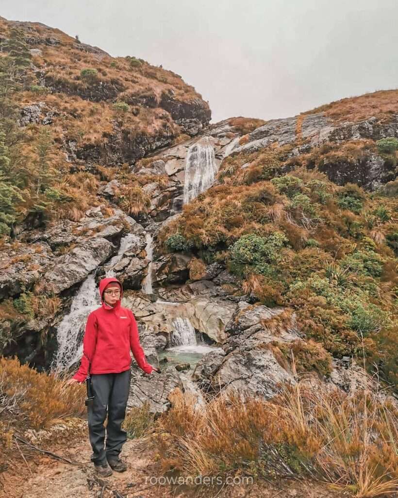
Young families may consider doing a 2D1N return tramp to Routeburn Falls Hut. Several waterfalls are within short walking distance from the hut. Those into astrophotography will like the unobstructed view of the night sky behind the mountains.
Having elaborated so much on Routeburn Falls Flat, how about the other hut we stayed in?
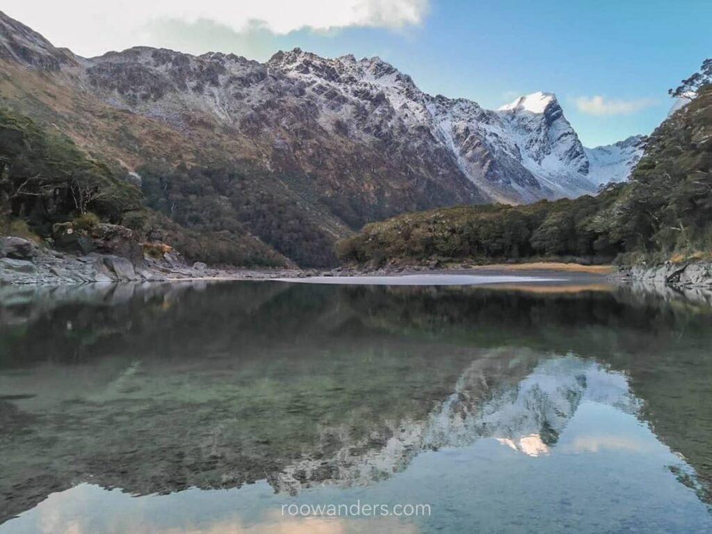
Lake Mackenzie’s site was unexpectedly dull. Maybe it was the season I was there. Winter has shrunk the lake and frozen its sides. The expectation of a large gleaming lake evaporated upon reaching the site.
It costs NZD 15 for a bunk bed in the hut during non-Great Walk season and a whopping NZD 65 during the season. Backcountry passes can be used.
Campsites cost NZD 5 per person during the off-season or NZD 20 during the season.
Our Version of The Track in Brief
Day 1: Routeburn Carpark to Routeburn Falls Hut (9.8 km)
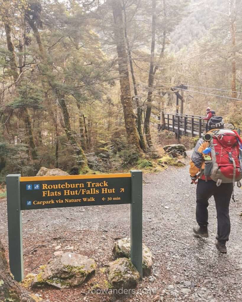
- Easy day to the hut
- Relatively flat walk through the forest from the carpark
- It was very cold in the forest in June
- Side trip: tramp to the falls and scramble down if you can
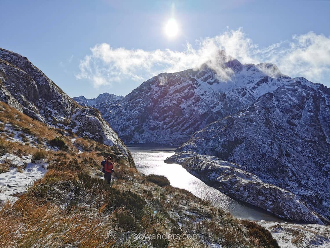
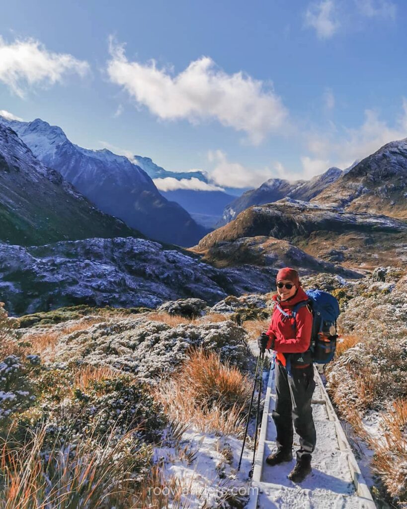
Day 2: Routeburn Falls Hut to Lake Mackenzie Hut (11.3 km)

- Easy walk across boardwalks through tussock-covered flats and wetlands
- Steady but manageable climb to Harris Saddle
- Strong winds across the ridgeline – Harris Saddle Shelter provided some respite
- Descend the exposed face of the mountain to Lake Mackenzie Hut
- Side trip: ascend Conical Hill at 1,515 m for a panoramic vantage point (you could leave your bags in the shelter)
Day 3: Lake Mackenzie Hut to Routeburn Carpark (21.1 km)
Items to Note
- Conical Hill side trip. We did not attempt this ascent due to the bad weather. You could leave your bag in the shelter before going up.
- Fill up your water before you rest for the day. Especially during winter. Water freezes overnight and renders the tap useless. You might not be able to get any water the next morning.
- Crampons, ice axes and a personal locator beacon (PLB) are necessary during the off-season. There could be heavy snow along the track. Rent them in Te Anau or Queenstown DOC.
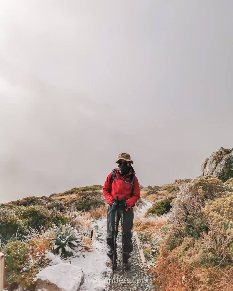
- Wear layers during winter. It can get warm on the ridgeline during midday.
Video


You May Also Like
Campervan Adventure in New Zealand with JUCY
Atop the Stunning Ben Lomond of New Zealand