The Mestia To Ushguli 4-Day Trek: A Complete Guide
Beautiful country Georgia – not to be confused with the US state of the same name – is a mixture of East and West. The Caucasus in Georgia is one such beautiful place to hike. Of these, the trek from Mestia to Ushguli is the most popular.
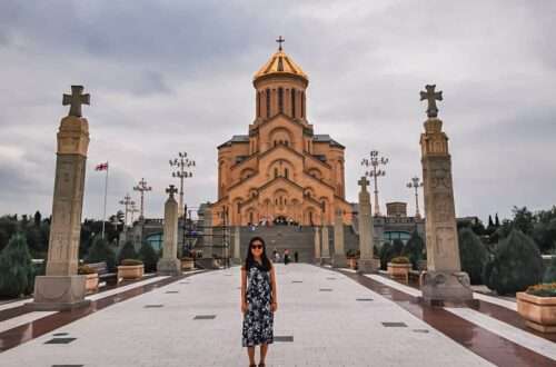
Situated at the intersection of Europe and Asia, the former Soviet Republic has beautiful Black Sea beaches, towering mountains and ancient architecture.
But how and why would a Singaporean girl – me! – want to travel to this relatively unknown country that is neither East nor West?
Georgia, Azerbaijan and Armenia make up the Caucasus region – a patch of mountains that acts as a natural barrier between East and West. The Caucasus isn’t what we studied in school, much less would want to visit unless you are that curious. The journey to get there from Singapore was long and arduous. But once you’re there, you’ll realise how affordable it is! We saw no crowds like those in Western Europe, felt safe in this country, and enjoyed our trip.
Aside from its interesting culture and delicious food, Georgia is a hiker’s wonderland, as much as New Zealand! The hike also reminded me of an earlier hike I did in the fairytale-like Yubeng Village of Shangri-La, China.
With just two weeks of my annual leaves dedicated to the Caucasus, time is limited, and there is only so much I can do.
So here goes – my multi-day trek in Svaneti, Caucasus, from Mestia to Ushguli.
This trek was completed in Aug 2019. Post may be updated periodically.
Mestia to Ushguli: The Track
The Mestia to Ushguli track is one of the popular multi-day treks in the country. I first read about it from a website created specifically for trekking in the Caucasus. The creator, Josef, did a great job collating all the possible routes in Georgia. His site is the best I’ve seen thus far.
The conventional route goes like this:
- Day 1: Mestia – Zhabeshi (16.1 km)
- Day 2: Zhabeshi – Adishi (10.6 km)
- Day 3: Adishi – Iprali (18.7 km)
- Day 4: Iprali – Ushguli (12.4 km)
Based on information from Josef’s site, the journey would cross 57 km and take four days.
The Track I Took
For my trip, I err away from the usual and added a bit more challenge and scenery. The result is this:
- Day 1: Mestia – Tsvirmi (we took the ski lift)
- Day 2: Tsvirmi – Adishi (only managed to capture data after Tetnuldi Resort: ⬆:420 m, ⬇:85 m, 7.5 km, 3 hours, Highest altitude: 2,170 m)
- Day 3: Adishi – Khalde (⬆:950 m, ⬇:960 m, 18.5 km, 8 hours, Highest altitude: 2,691 m)
- Day 4: Khalde – Ushguli (⬆:1,070 m, ⬇:1,000 m,16 km, 9.30 hours, Highest altitude: 3,022 m)
Most of my trek follows the conventional route. What differs is the Lagem Pass (Southern Karetta Crossing) to Ushguli on Day 4, which rises to a height of 3,000 m.
Accommodation
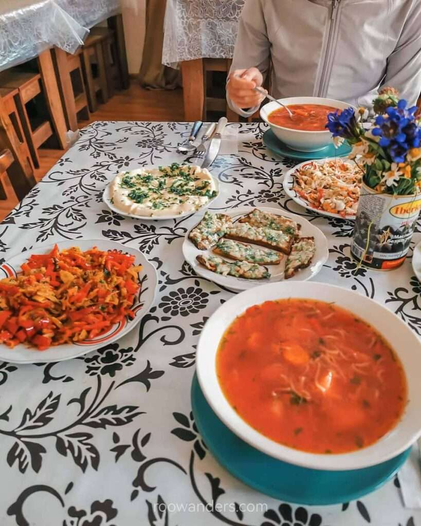
There are many guest houses along the way, so a tent is impractical. Most guesthouses prepare meals too, though the level of deliciousness would differ. They pack lunch boxes too.
If you are paranoid and must have a bed booked, or would be trekking during a busy period, know that most guest houses have an online presence on your usual booking platforms like booking dot com, hostelworld or Agoda.
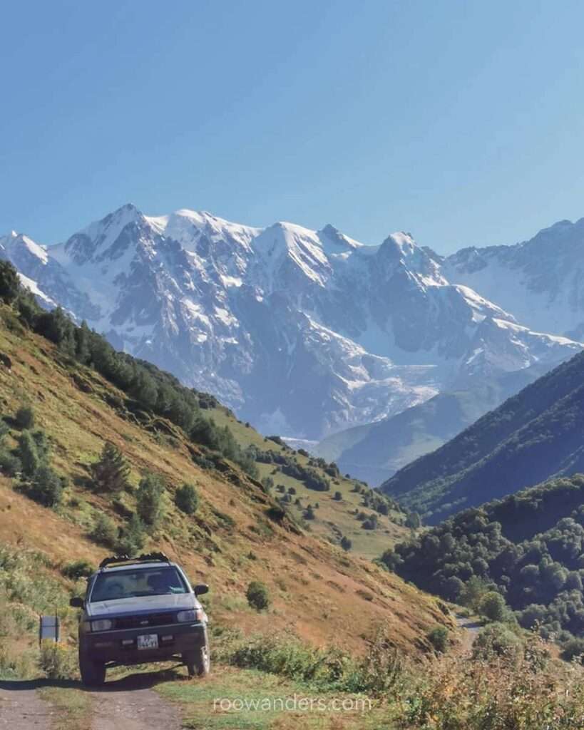
Transport
Getting to Mestia is a bit complicated.
You’ll probably be coming from the capital Tbilisi.
To get to Mestia, take an overnight train from Tbilisi to Zugdidi, then switch to a marshrutka – a van/ small bus in Georgia – to Mestia.
Train
Get your train ticket sorted out online from Georgian Railway. The website has an English version, but the inbuilt translation for Georgian on Google Chrome works better.
Create an account – you have to – to buy a ticket from Tbilisi-Pass to Zugdidi.
Timings might have changed since then, but the sleeper train I took left Tbilisi around 9.40 pm to reach Zugdidi at 6.25 am.
Georgian Railway has an app for your digital tickets, and the conductors are very diligent at checking your tickets. To be on the safer side, I printed mine out – just in case my phone or the app does not work.
How early do you have to book your tickets? You could go as early as four weeks if your travel coincides with the European summer vacation.
Prices (2019):
- Class I (2 sleepers): 35 lari
- Class II (4-berths): 21 lari
- Class III (seats): 8.5 lari
Marshrutka
For the second leg of your journey, leave the train to board one of the many marshrutkas waiting by the train station.
Drivers tend to yell for people to fill their vans as fast as possible so they can leave. Be quick to get into one and depart early.
Our journey from Zugdidi to Mestia was smooth sailing and took us three hours.
Price: 20 lari/ person (2019)
Back to Tbilisi
Find your way back to Tbilisi in the same manner as above, but throw another marshrutka from Ushguli to Mestia.
We found ours from our backpackers and left Ushguli at 10.30 am. The two hours journey back was over a potholed road with several river crossings. I guess that justifies the higher cost (40 lari).
Upon reaching Mestia, we had a late lunch and loitered around the visitor centre where the Zugdidi-Mestia marshrutka first dropped us five days ago. They swung by to pick up passengers in the late afternoon, and we were back in Zugdidi for dinner, followed by the night train back to Tbilisi.
My Experience
Day 1: Mestia to Tsvirmi
We tried to pick up physical copies of the map from the visitor centre, but the queue was too darn long.
In the end, we relied on pre-downloaded offline maps from Maps.me, which worked pretty well except for certain places where our GPS location betrayed us. Warning: do not trust the over-ambitious forecasted duration. It never works and makes you doubt your abilities.
Hatsvali Ski Cable
We set off from Seti Square to the lower Hatsvali cable station, passing by the neighbourhood and the local museum.
The plan was to take the cable up and cut down our hiking time over the steep Zuruldi range to reach the village of Tsvirmi before sunset.
But lo and behold, the cable car decided to fail us that morning. A group of hikers around the station told us technicians working on it said it could take as long as twenty minutes, two hours or two days to get it fixed. Huh?
Just when we thought we should pursue the conventional route and walk to Zhabeshi instead, a tour guide leading a group of retired Europeans came and spoke to the technicians. Twenty mins or two days became five minutes, and we were back on track!
Needless to say, the guide and his customers went first. The trip cost us 15 lari pp.
There were two cables to take – the first cable was over a forest. We saw hikers below us trekking up. The second cable stole the show with the best views of Mount Ushba, though that needed some neck straining since we were travelling in the opposite direction.
A cafe at the top had beer, coffee and simple pastries overlooking the gorgeous mountain range.
Mentashi Transmitter
Nothing fancy between the cafe and the mentashi transmitter. It was generally flat with lots of day hikers.
Descending from Mentashi Hill was a pain.

The steep gradient and unclear path made it a challenge, but we still survived to tell the tale.
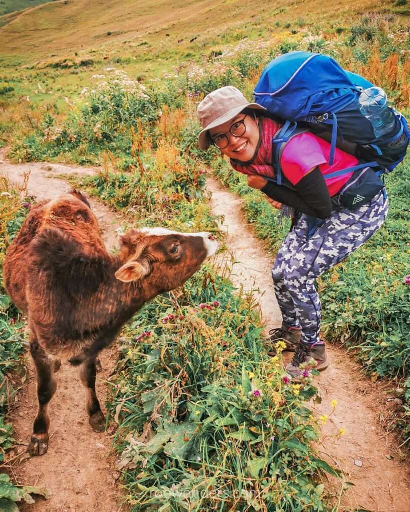
Then it was a pleasant walk over trees and meadows and the occasional cow to the village Tsvirmi.
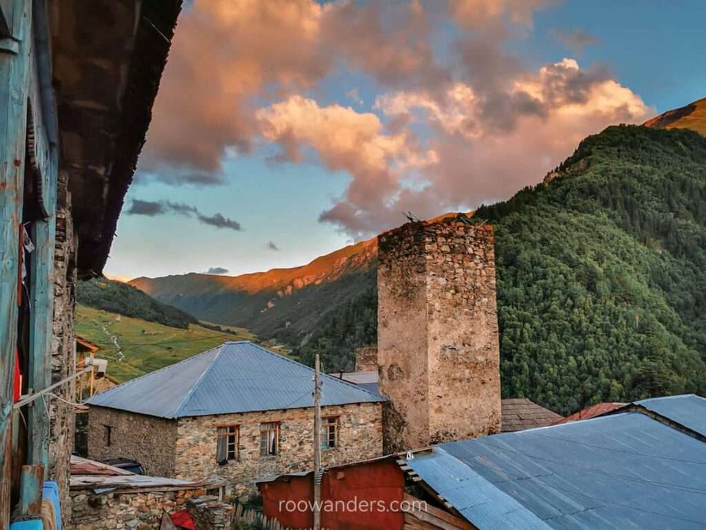
Tsvirmi
We descended over a slippery loose gravel slope towards the village. Along the way, we met a group of Europeans trying to find transport back to Mestia.
I’m not sure if they succeeded, but it was getting dark, and the sky began to drizzle.
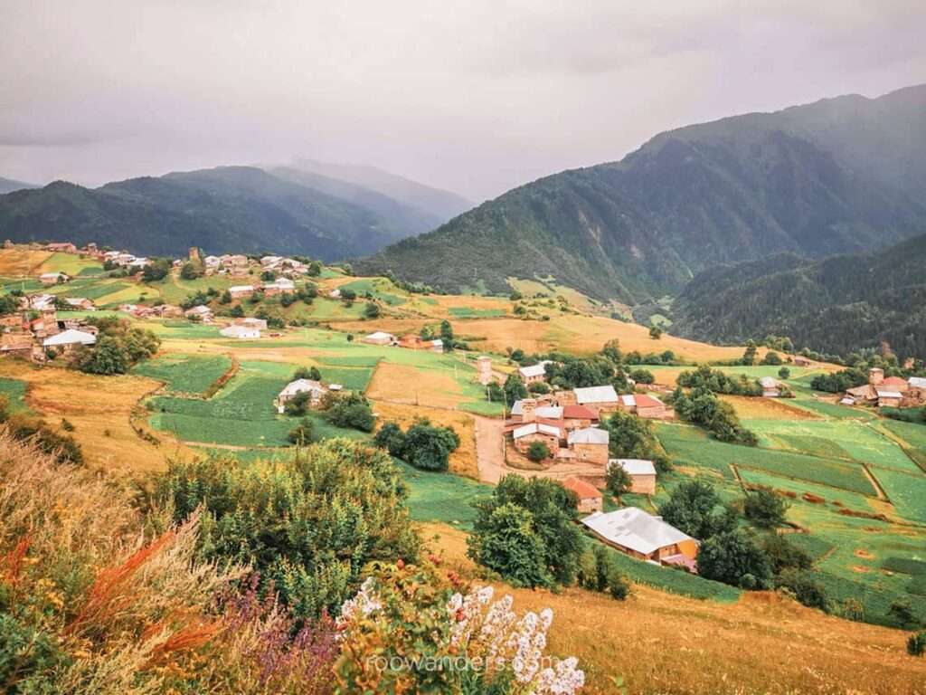
The small village of Tsvirmi had no guest houses with an online presence when we were there. We randomly stumbled into a cottage with a grandpa who welcomed us in with a smattering of English.
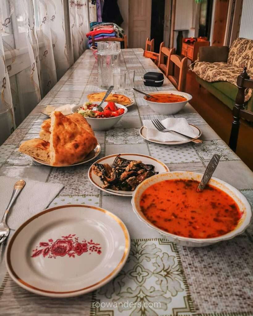
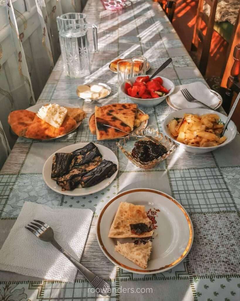
He and his wife prepared a table full of homemade delectables like stuffed aubergines and bread.
We spent 150 lari for two a night, including dinner and breakfast.
Day 2: Tsvirmi to Adishi
Day 2 started as a brilliant morning on a boring and dusty gravel road.

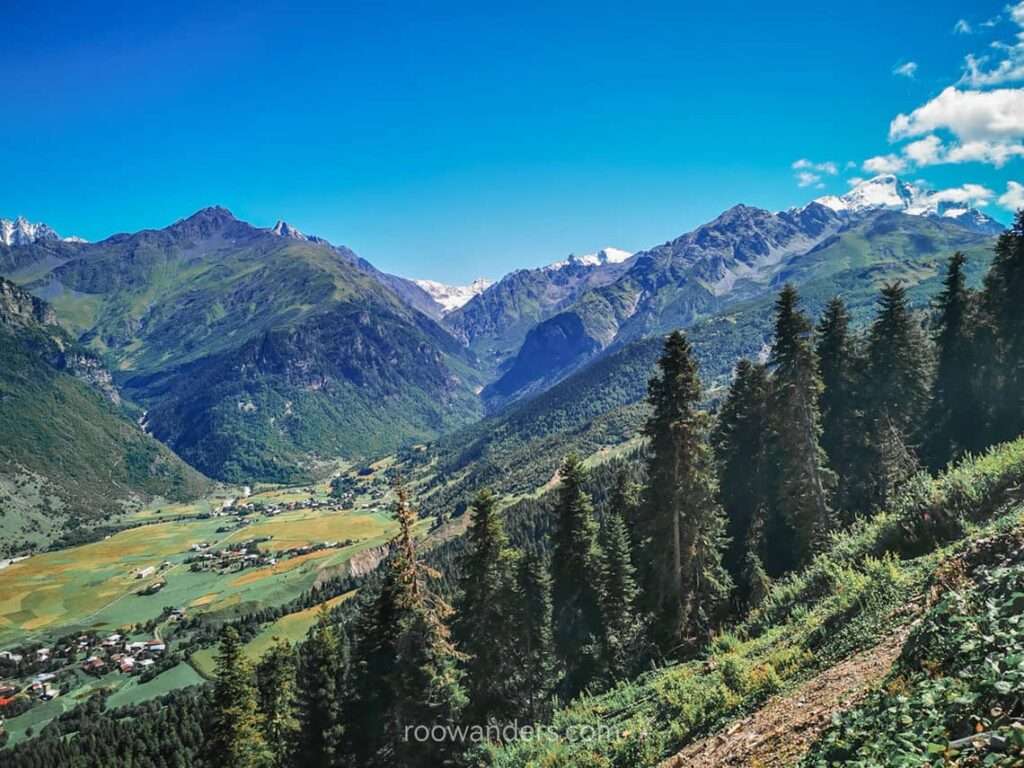
We trekked out of Tsvirmi, enveloped by the cacophony of chirping cicadas and birds.
Boring road aside, we did meet three interesting parties along the way: (1) an uncle doing his daily walks who tried to talk to us despite the language barrier; (2) a group of Catalans with small daypacks attempting the same Mestia – Ushguli route; and (3) a cute dog guarding a church.
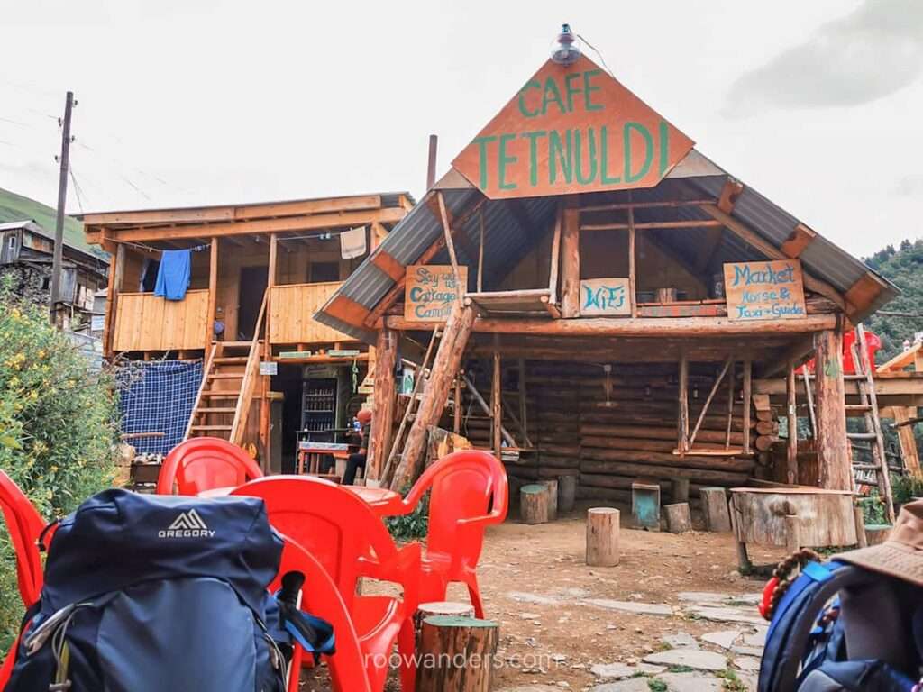
Tetnuldi Ski Resort
Nothing is fascinating here, as with all ski resorts in the off-season.
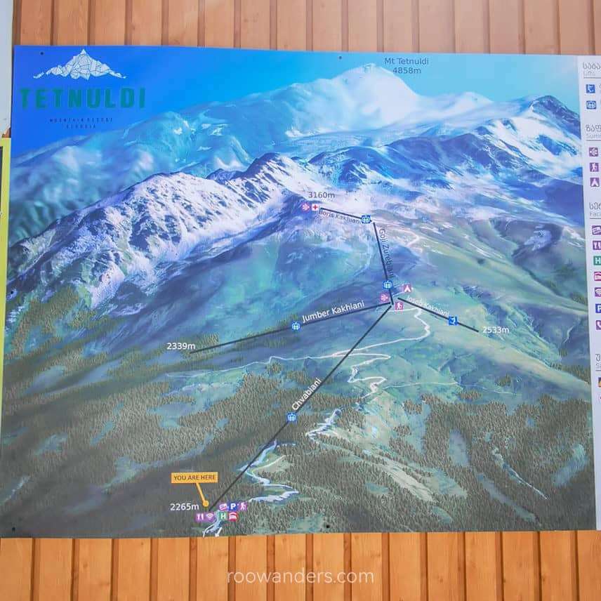
You could take the cable lift to the mountain top from the ski resort – as an American couple did. The view from above must have been amazing. I’m not sure if they did eventually hike down to Adishi or went on to do some other treks.
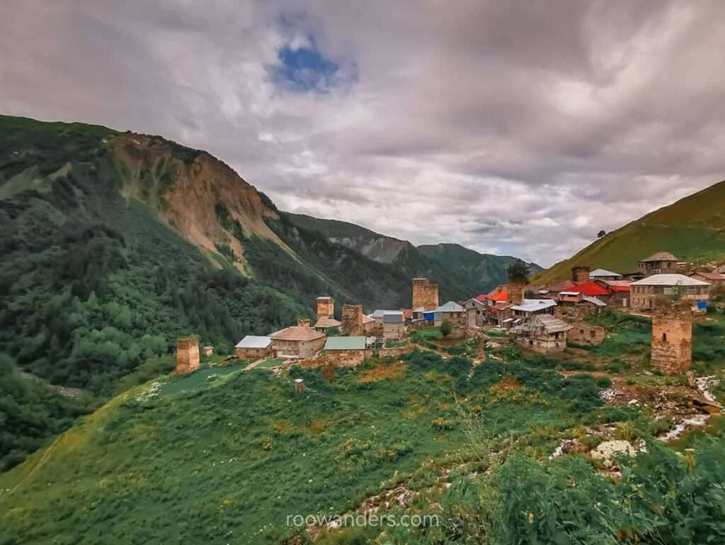
Adishi
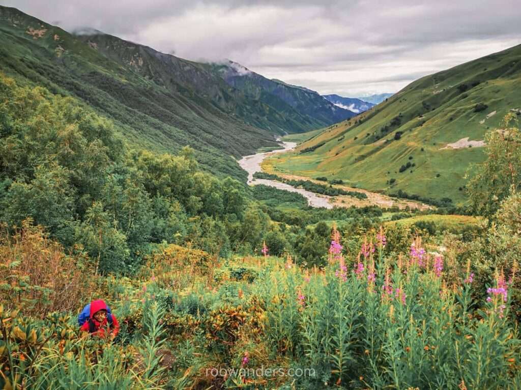
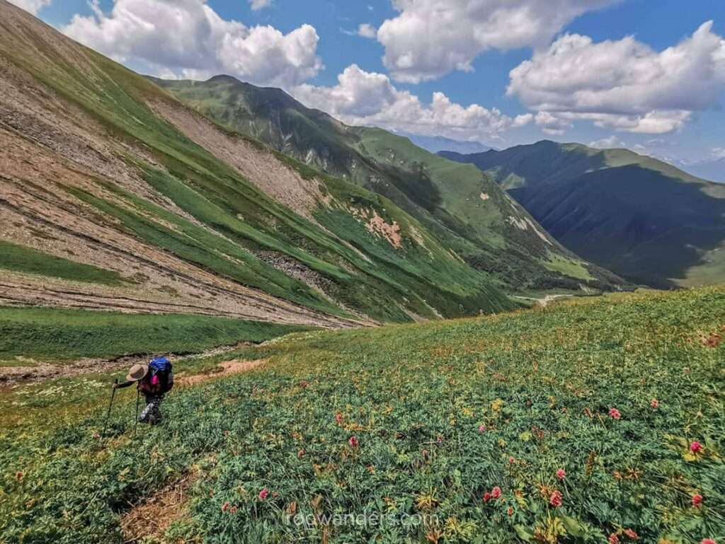
The last leg of our journey was comparatively better – no more dusty road!
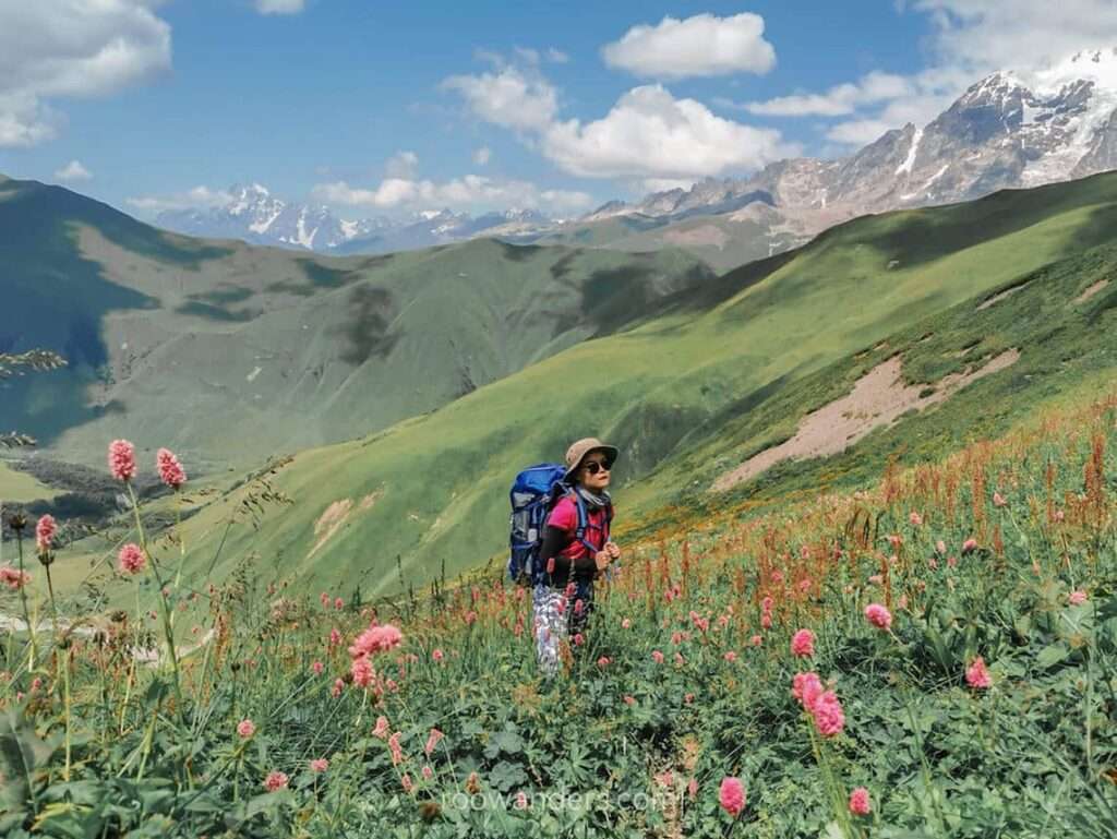
Colourful flowers and dancing butterflies welcomed us as though we were Disney princesses. Or you could think of it as the dreamy European mountain scene of The Sound of Music.
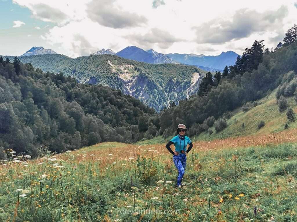
Take note that there was no shade nor hydration along the way for us, so bring enough sun protection and water.
Then came the slippery scree route down to Adishi – not too difficult – and we were in our pre-booked guest house moments later.
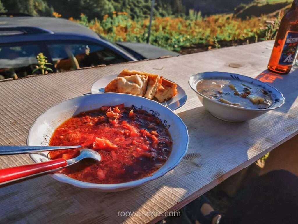
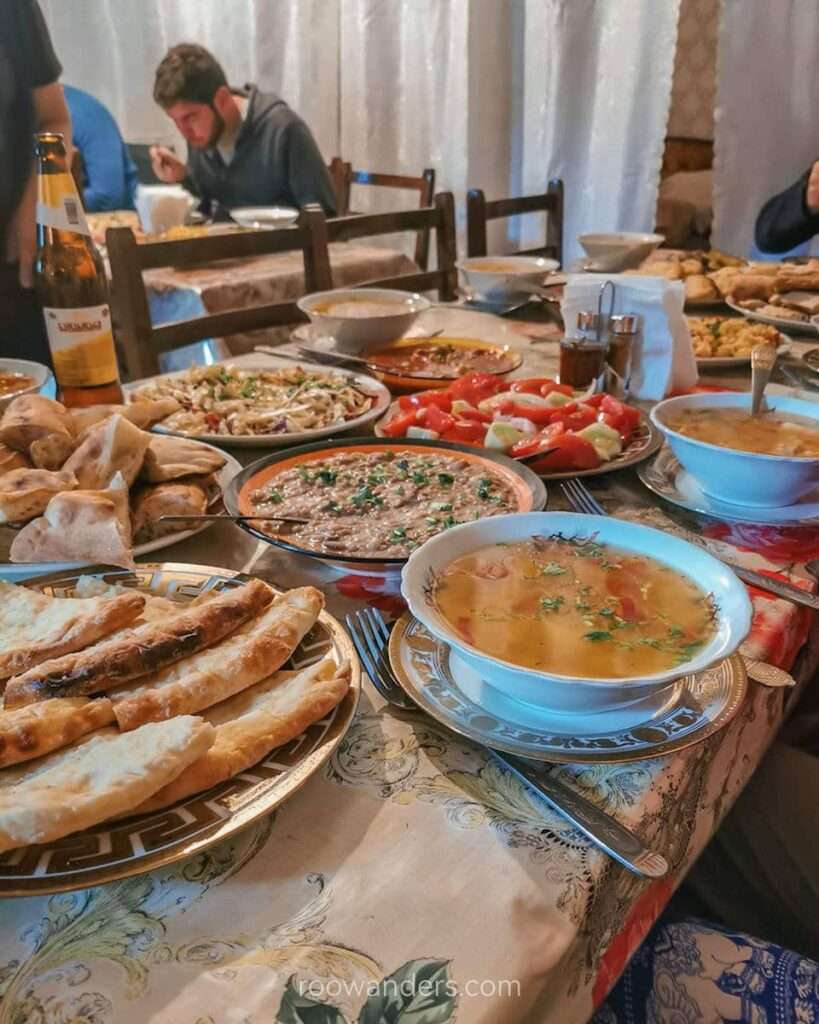
As the cook of our guest house was away at a funeral that week, all patrons had to source for their meals elsewhere. We had beer, goulash and soup at Tetnuldi Cafe for dinner. The takeaway lunches – pastries – we ordered during breakfast were soggy by the time we had them.
Day 3: Adishi to Khalde
We had good weather on the second day but not on our third day.
The third day of our multi-day tramp started dreary with rain that came intermittently and with varying intensities.
Josef mentioned a river crossing that had to be done early when the level was low, and we followed his advice. But with an overnight rain thrown in, expectations and reality differ.
After an hour of trekking over muddy puddles, we saw horsemen heading back to Adishi. Hmm, that doesn’t look good.
According to Josef’s guide, horsemen usually wait by the river to ferry trekkers across for about 20 GEL per person – not a small sum! Seeing them return to Adishi could only mean (1) the water level has gone atrociously high, or (2) no one’s there for them to ferry. We could only hope for the latter.
Crossing Adishi River
Crossing the glacial cold river water was made even more chilling by the strong currents.
We walked upstream and went with the shallowest part of the river, as the narrowest part downstream was too dangerous. That meant crossing three streams or dipping into the frigid water three times.
I could feel the pull of the currents as I trod across the river with the water level rising beyond my knees. Now that I am updating this post after spending two years in New Zealand, this episode wasn’t as dreadful as I thought. Instead, I found it hilarious. Sure the level was higher, and the current was stronger, but we were doing it with care and within our limits. I suppose it was indeed terrible for someone doing her first self-planned multi-day tramp.
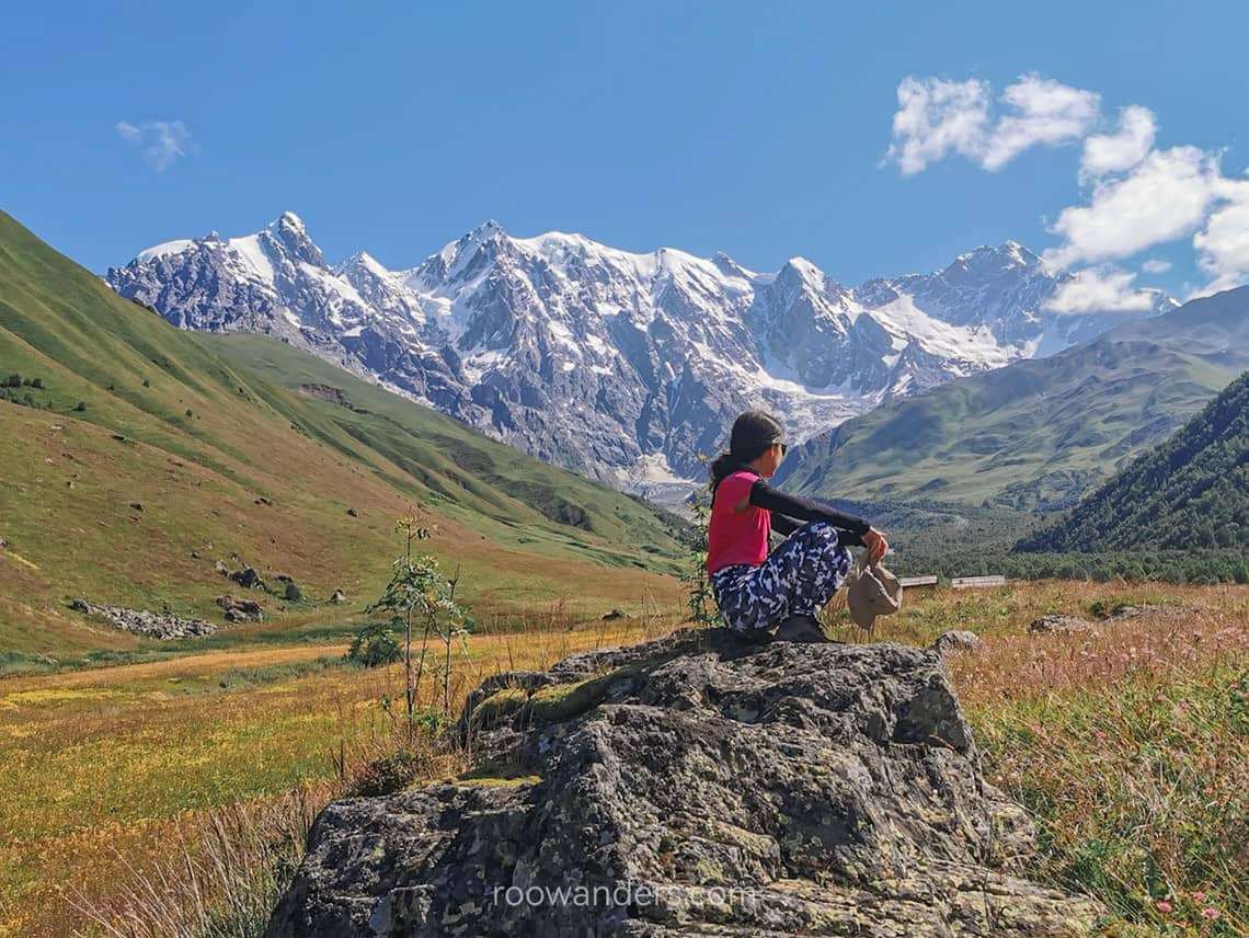
Adishi Glacier
Post river fording, we stopped by a clearing to have lunch with the Adishi Glacier right in front of us.
I might have seen glaciers before this tramp, but the sight of Adishi Glacier shall forever be ingrained in my mind. The blues intermingled with some greens and whites, and by their side were bushes peppered with red and yellow flowers.
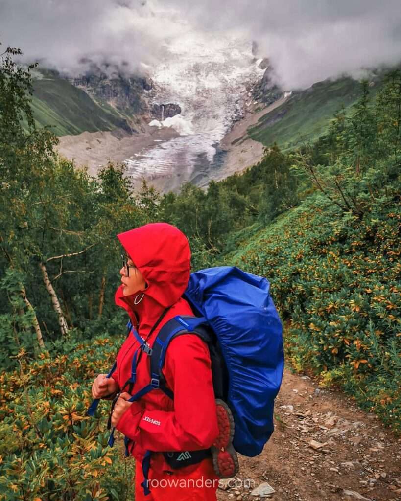
Our lunch episode triggered all five senses, and all five combined have been living rent-free in my mind thus far, safely parked under the cabinet marked for my impressive long walks. We tasted soggy pastry, saw a beautiful glacier, felt the cool air, smelt the rain, and heard distant avalanches.
Chkhunderi Pass
It was another hour of merciless ascent to reach the highest altitude of that day – 2655 m over Chkhunderi Pass.
When there’s a mighty ascent, there will be a mightier descent. I banged several of my toenails dead from that.
Checking the condition of a bridge
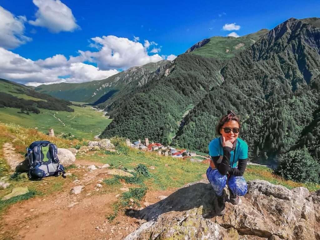
Just before we crossed the divide to Khalde, we hiked a bit more to check on the condition of a bridge we were supposed to cross the next day. According to Josef, the poorly maintained old bridge may collapse. We saw it was still holding up, so the plan remained as scheduled.
With the checks done, we rerouted towards Khalde – a very small village – for the night. That journey wasn’t short either – it took us an hour and a half over streams and rocky paths to reach one of the two guesthouses.
You can imagine how relieved I was to strip my feet bare and sink into a seat after the hike – never mind that we had to fight 20 over occupants for that one shower with hot water.
Day 4: Khalde to Ushguli via Lagem Pass (Southern Karetta Pass)
Another lovely morning to begin with compared to the rain from the previous day.
For our hike that day, we left early and retraced our way back to the bridge.
Crossing the rickety old bridge
Crossing the bridge was nerve-wracking – the old bridge supported by just two thick wooden poles and a few planks scattered in between looked dubious.
Underneath it was the turbulent milky blue Khaldechala River.
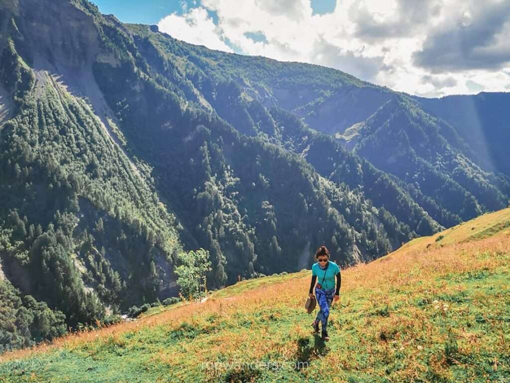
Ascent to Lagem Pass
We left the bridge, cut across a meadow, and bashed through the bushes – all these while the gradient gradually steepened.
For most of that day’s trek, I recall trampling over slippery roots and branches of rhododendrons, mud and field flowers. We somehow reached a spot so steep that you’d need the hiking sticks.
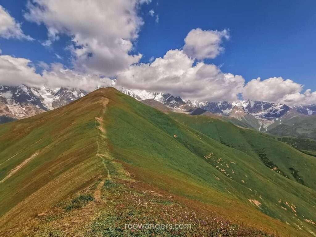
It wasn’t long before we reached the top of the Lagem Pass (3,000 m). There’s an even higher vantage point at 3,200 m – we saw two hikers there – but the effort was too much, and we risked running late.
Descent and Ushguli
Descending was treacherous. I was walking – and falling five or six times – on the steep mountainside at an awkward angle.
You would have tumbled too – the so-called path was slippery from mud, grass, and the occasional loose gravel. Actually, there weren’t any proper paths. Someone had to walk it out.
The two pro hikers from the top raced down and cleared the way for us. But they were too quick and we lost them. We later spotted one of them – wearing bright yellow – already across the Inguri River.
We couldn’t figure out how and where they crossed to the other side. The further we ventured, the steeper the drop to the bottom of the valley. Those hikers seemed to have floated over.
As the outskirts of Ushguli slowly came into sight – we saw more jeeps, people and horses on the other side – dread started streaming in. We were still at a height across the river from the other side. Are we on the right path to Ushguli?
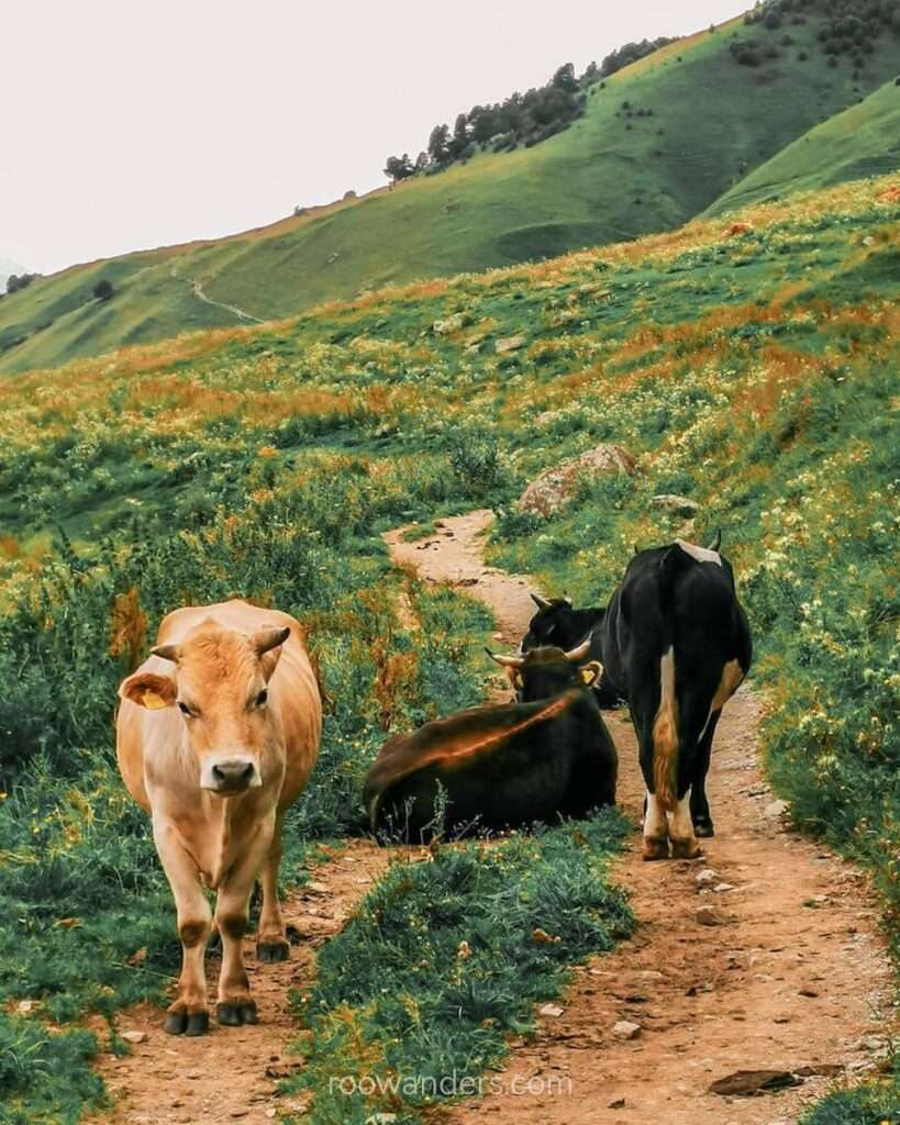
Then we saw a cow. And another. And soon, we were walking through a large group of grazing cows and horses. If these farm animals are here, surely there must be a way across.
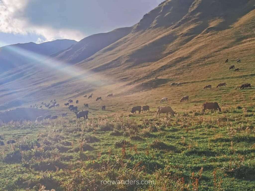
And we were right. Not long after, we reached a gradual descent from the ridge to a concrete bridge, and finally, Ushguli!
Pointers
- Clean sheets/ liner. For hygiene in the train/ dorms. The beds for our overnight train were old, and the walls were gross. At least the toilet was cleaner than the trains in Western Europe. They rent clean sheets for 4 GEL
- Power banks. Don’t we all need to power our phones? You need the digital map or GPS from your phone. Also to track your progress.
- Bookings. Important during peak tramping period – i.e. holidays, summers
- Sun Protection.
- Wind and rain protection.
- Proper hiking shoes.
- Hiking poles.
- Camera. Beautiful scenery.
- Cash. No ATM.
- Pick me up snacks. I would have replaced the packed soggy lunches with dry biscuits instead.
- Hydration. Pack enough water. You may fill up your bottles from the streams at your own risk.
- Day trip to Shkhara Glacier. If you are game for more walks in Ushguli.
Ending
The Mestia – Ushguli is a walk you must not miss if you are in Georgia (and have spare time to do so). Sure, you could travel to Mestia and Ushguli separately, but then you’ll miss out on all the nice sights in between. Adishi Glacier – and how it was framed by the greens surrounding it – was my highlight. The takeaway lunches were all bad, and some guesthouses can be ridiculous.
Nevertheless, this is definitely a trek to remember.