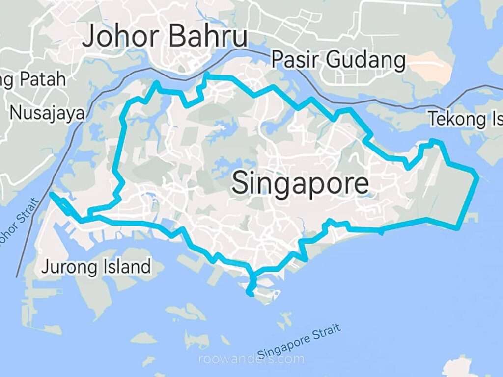
Singapore Round Island Walk | 160km 5 Days
As a resident of Singapore, how often would you venture to other parts of this small country? Apart from the school or your workplace, the usual jalan-jalan hangouts or your neighbourhood, I guess none, unless you go out to paktor, do cafe hopping, or cycle around the country every weekend. And that is why I found this Round Island Walk around Singapore a pilgrimage of sorts.
Because what business do most people have beyond the place they frequent? Singapore is so convenient that a supermarket/ food court/ pharmacy/ dentist/ bakery could be down under your block. Efficiency is so embedded in our society.
Doing this long walk in Singapore forces me to view our little red dot in a different light. So here is an account of my staggered 5-day walk around Singapore – for your reference or to inspire you to take the walk as well.
I did this long walk in Jul 2022. This post contains affiliate links that cost nothing to you but supports my blog. Cheers! Post may be updated periodically.
Size of Singapore
To put things into perspective, Singapore is 728.6 km² or 0.9 times the size of New York City. Singapore is slightly bigger than the supervolcano Lake Taupo in New Zealand (616 km²). Taiwan is 50 times bigger than Singapore. Check out this website for more comparisons.
Inspiration
Doing a round island walk is not that novel.
SGTrek, a local hiking group, had organised a round island walk challenge in 2020 – when the pandemic was still hanging around – to spur more to exercise outdoors. Their challenge was to complete the 150 km walk within October with GPS and photo evidence as proof. The group collaborated with several sponsors. You could even enter the Singapore Book of Records after completion.
Using their route map as a reference, I planned my long walk around the island. Apart from the route map, I have also found a few more inspirational reading materials as references.
A sibling duo completed their round-island walk within seven discontinuous days during the weekends, clocking in about 20 – 30 km every day. A man did it within three consecutive days, clocking in over 50 km each for the first two days. A CNA journalist duo completed a slightly smaller loop (142.5 km) over five continuous days. Actress Zoe Tay accompanied them on their third and fifth day of the walk.
The Singapore National Park has extensive maps and suggestions for walks around the island.
My Packing List
Do you even need a packing list? YES – since I am doing it solo, I must ensure I am comfortable throughout the day. Not all days lead to convenient toilet stops, water refill stations or shops. Items listed below in my old 25 L Gregory backpack:
- 1 L Nalgene bottle to refill my 500 mL flask
- Snacks – 2 hard-boiled eggs, peanut butter sandwich, assorted biscuits
- Umbrella + waterproof jacket
- Sunhat
- Sunscreen
I alternate between my wide-toe New Balance walking shoes and Merrell hiking shoes and swear by wearing five-toe socks to reduce blisters.
My Style of Walking
I have decided to do the walk in five days, clocking in at about 30 km or eight hours on most days. But the first day in, I realised my limits – doing it for five consecutive days was a pain and a dread. Blisters formed around my smaller digits, and I could not walk properly after Day 2 of 34.5 km.
So the long walk was structured into five alternate days, mixed in with two hours of yin yoga on rest days.
Also, if you are wondering if I sleep rough – the answer is no. Why would I do that when Singapore’s transport system is that fast and convenient, and I have a comfortable bed to rest in at the end of the day? Besides, it is illegal to camp beyond designated campsites in Singapore – I wouldn’t want to risk getting myself STOMPed in the local media.
I start my walking days before 6.30 am and structure them specifically on weekdays since I am doing it alone.
Walks are recorded using Relive as this app creates a fancy video recap.
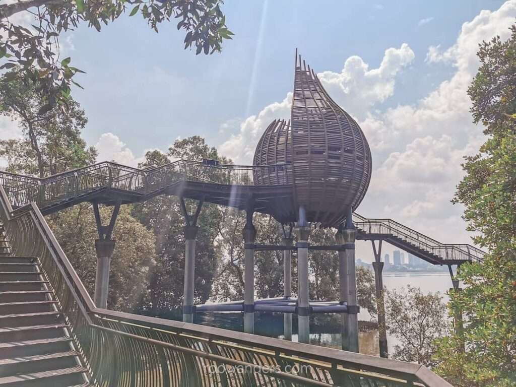
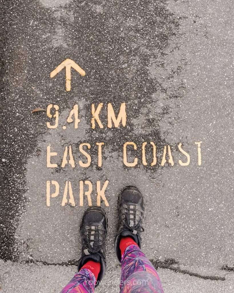
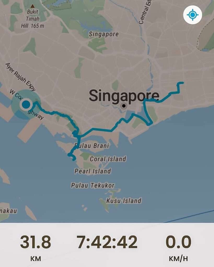
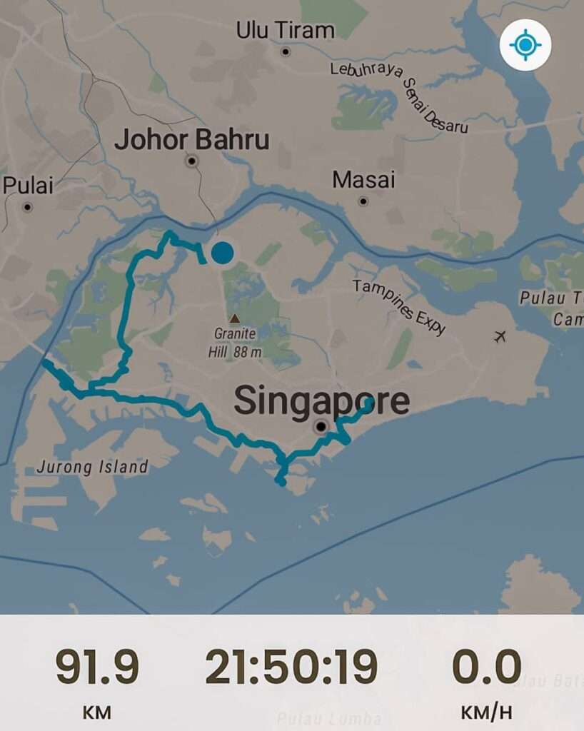
Day 1: Paya Lebar to Haw Par Villa MRT | 31.8 km, 7.5 h
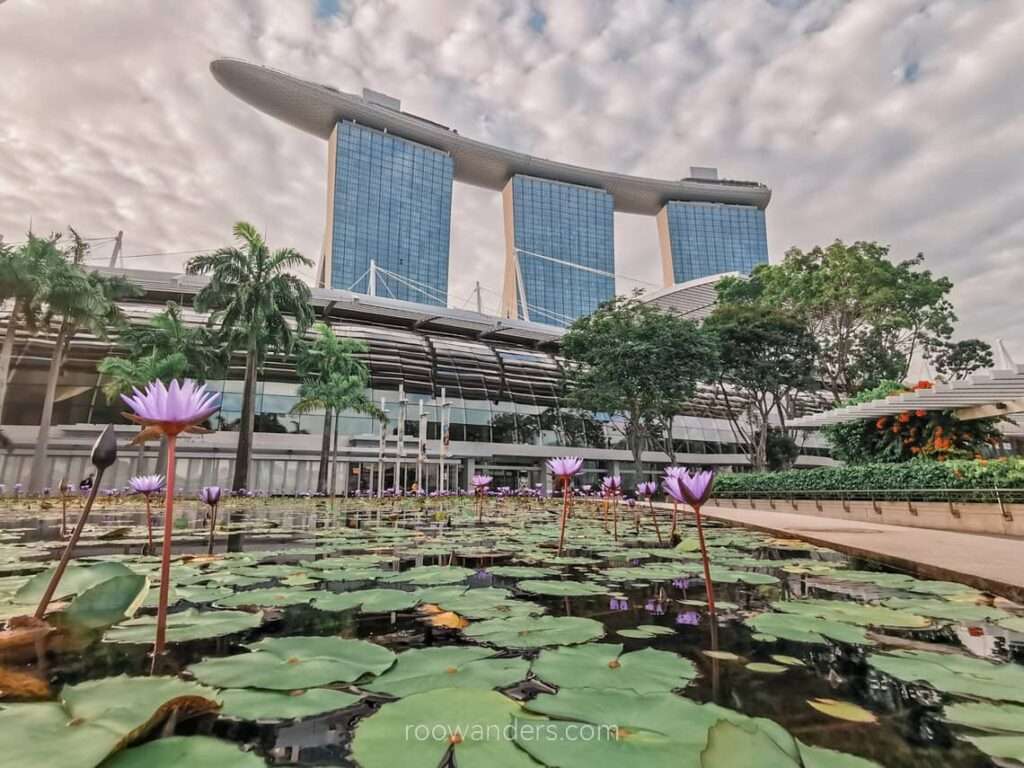
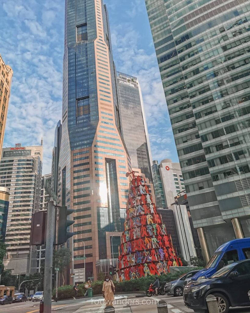
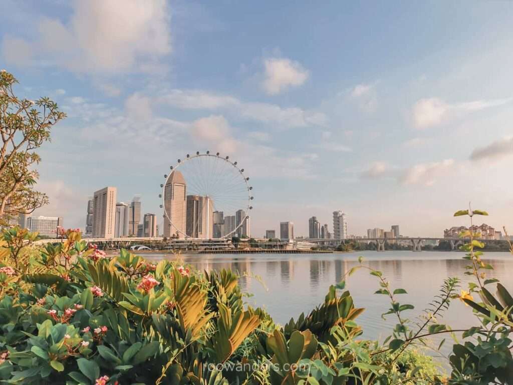
Paya Lebar to Marina Bay Sands
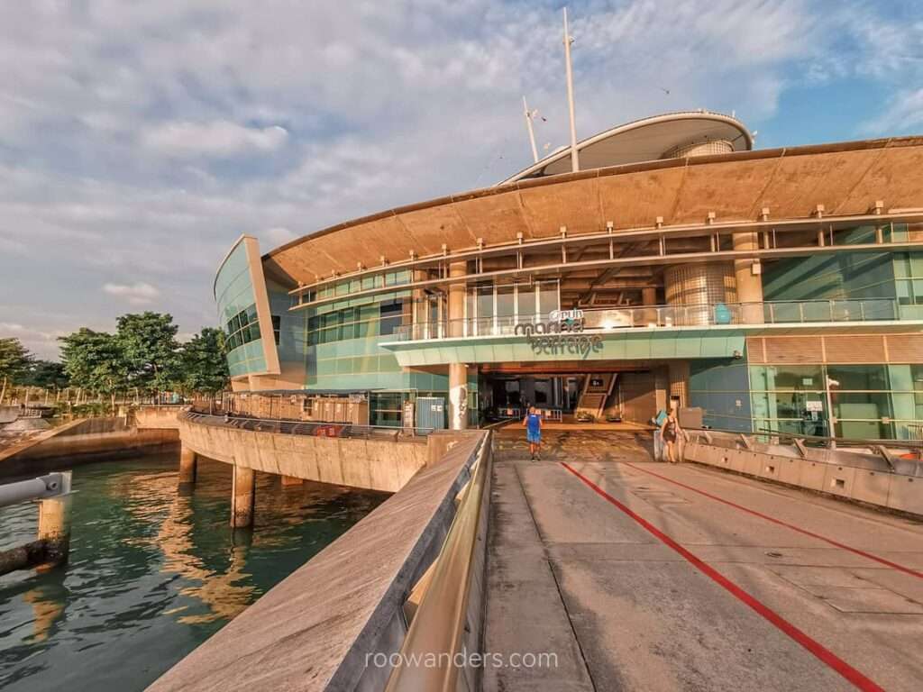
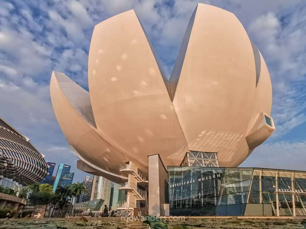
I have done this track several times, mostly on a bike. A beautiful stroll on park connectors along the Geylang River, over Tanjong Rhu, Bay East Garden, Marina Barrage, the domes, and the iconic Marina Bay Sands.
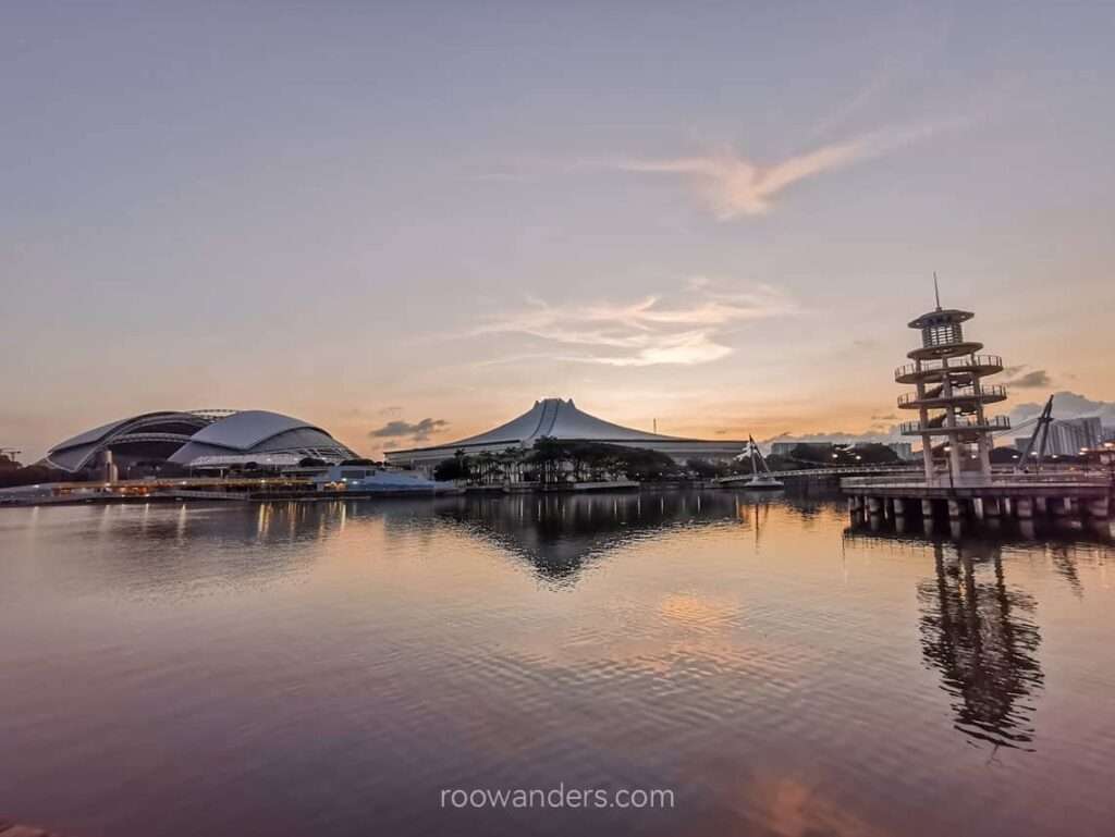
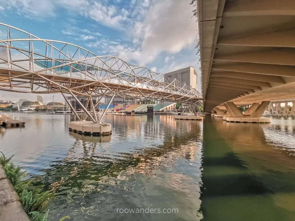
One of my favourite tracks as it is away from the dusty and noisy traffic and passes through several iconic spots in Singapore. Several others were walking and running on the park connectors, mostly around the Bay Sands loop (Marina Bay Sands – Fullerton – Esplanade Bridge – The Float – Helix Bridge – Marina Bay Sands).
Marina Bay Sands to Sentosa
I walked to the end of the park connector and exited Shenton Way, where the morning commuters were off for work. Shenton Way was abuzz with activity, and I was the odd one in tights and a hiking backpack.
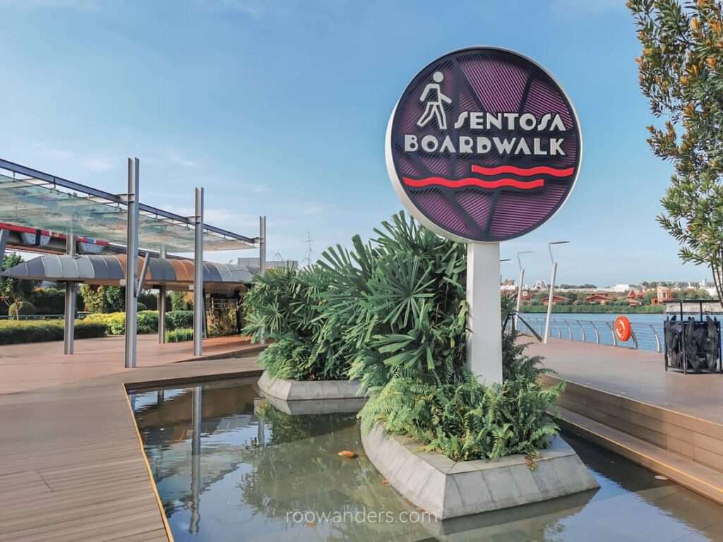
From Shenton Way, I continued my journey along the Keppel Viaduct, an unpleasant walk by a busy and dusty road, towards the Sentosa Boardwalk.
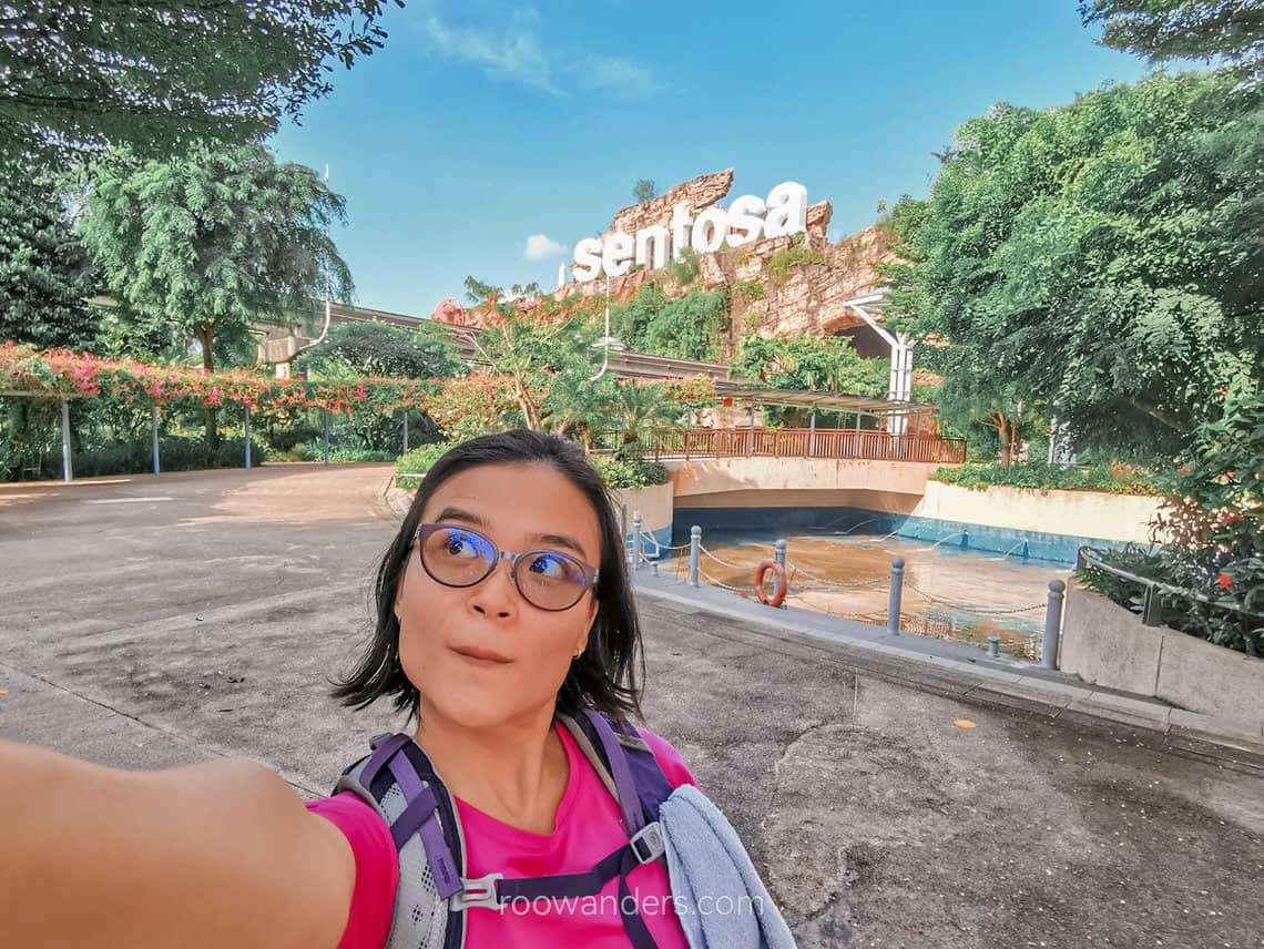
Sentosa
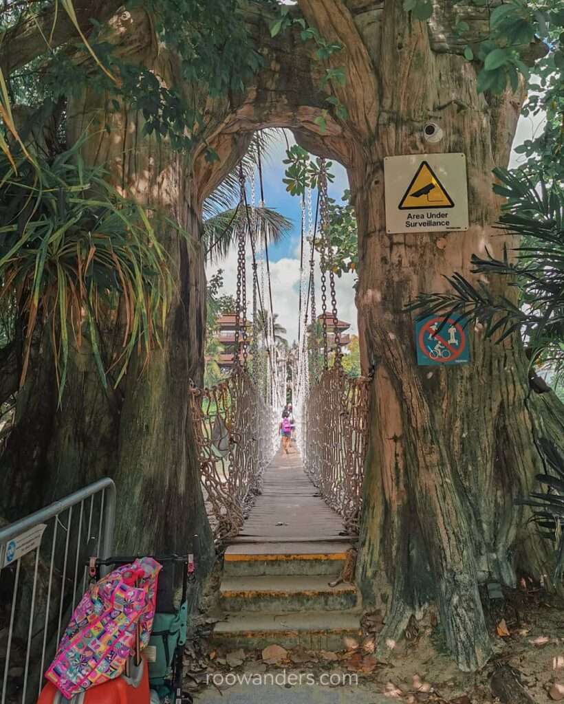
Following the route designed by SGTrek, I trailed south, passing the very early visitors at Universal Studios and Resort Worlds, before making my way towards the tiny Palawan Island, the Southernmost Point of Continental Asia, via a small suspension bridge.
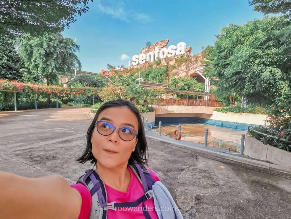
We have the Southernmost Point!? Yes, we do, and it was hard for me to take in despite living in this country since donkey years ago. It is geographically factual, just that no citizens cared unless they explored like the tourists, or did this exploratory long walk.
I stopped for a toilet break and refilled my bottle at Sentosa.
Seah Im for Lunch
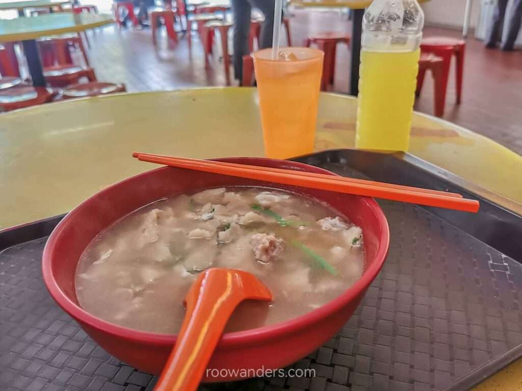
I retraced my route out of Sentosa and had lunch at Seah Im Food Centre, my frequent lunch stop when I was an intern back in my schooling days. Unfortunately, the place would be closed for a half-year renovation in September 2022.
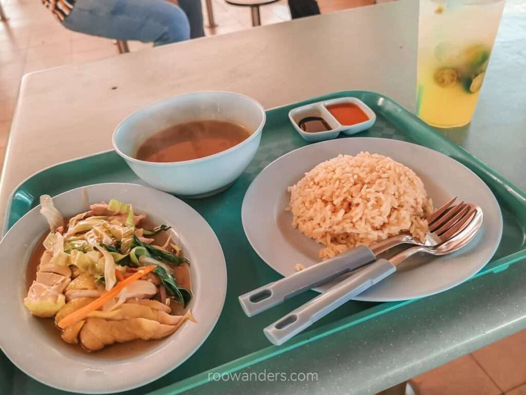
Lunch was chicken rice since there wasn’t any queue ($3.50) and lime juice ($1.50). The all-time favourite stalls were too long for me to wait.
Mount Faber to Kent Ridge Park
Post-lunch, I lost my way trying to figure out the shortest path to Mount Faber Park at the back of Seah Im Food Court.
After ten or twenty minutes of walking around and wondering if I should head straight to Henderson Waves via the West Coast Highway instead, I found the right path, which began from Marang Road Carpark, adjacent to the food court. It was a series of steps up the Marang Trail towards the fake mountain.
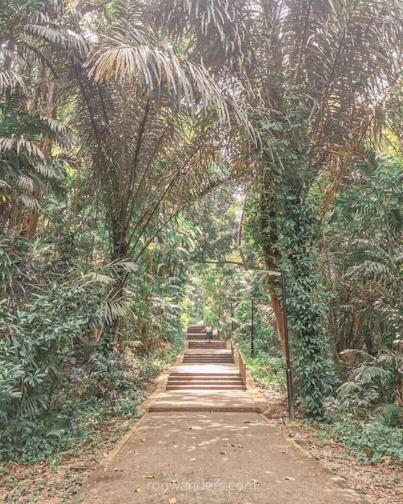
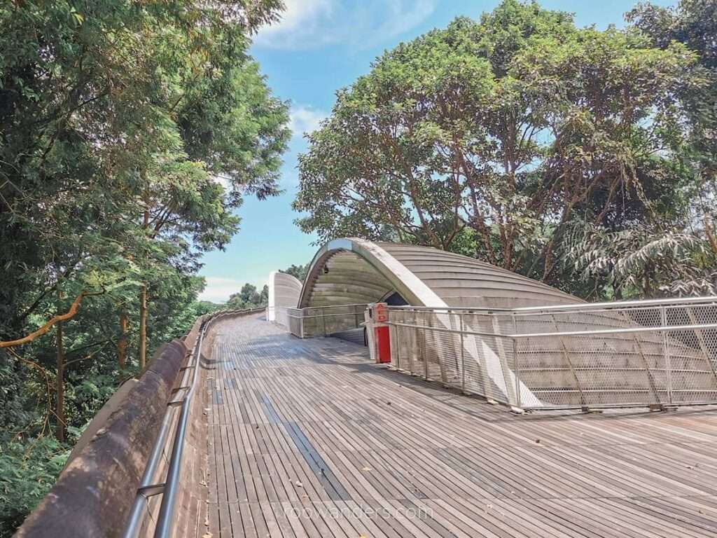
Mount Faber Park is part of the Southern Ridges Trail from Kent Ridge MRT to HarbourFront MRT. The trail passes through several unique spots, such as the Henderson Waves bridge and the treetop walk, which cuts across a secondary forest.
From Mount Faber, I crossed the wave-inspired bridge to Telok Blangah Hill Park and another bridge – Alexandra Arch – to Hort Park. Hort Park was hot and quiet. I refilled my bottle and continued towards Kent Ridge Park.
Haw Par Villa
There are a couple of attractions in Kent Ridge Park, as it was once a WWII battle site. I was too tired to visit all those attractions again, having been through those several times before.
From Kent Ridge Park, I walked down a small steep road, coined as one of the seven steepest roads in Singapore, towards Haw Par Villa MRT.
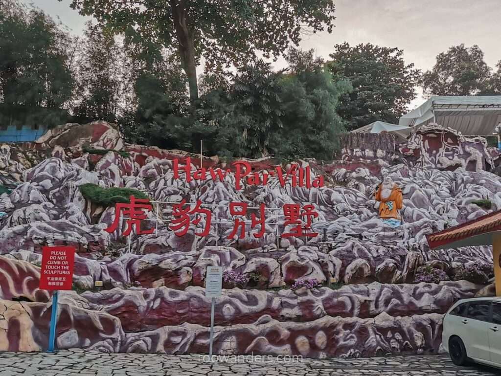
The Haw Par Villa park is probably the closest you can to visiting Asian hell. Built in 1937 the park is Singapore’s largest outdoor art gallery and a place to scare your kids into obedience. Found lying? You’ll get your tongue cut off in the 18 chambers of hell. The quirky park is also the brainchild of the founder of the world-renowned – and must-have ointment – Tiger Balm. Fun fact: you can now have your wedding in hell.
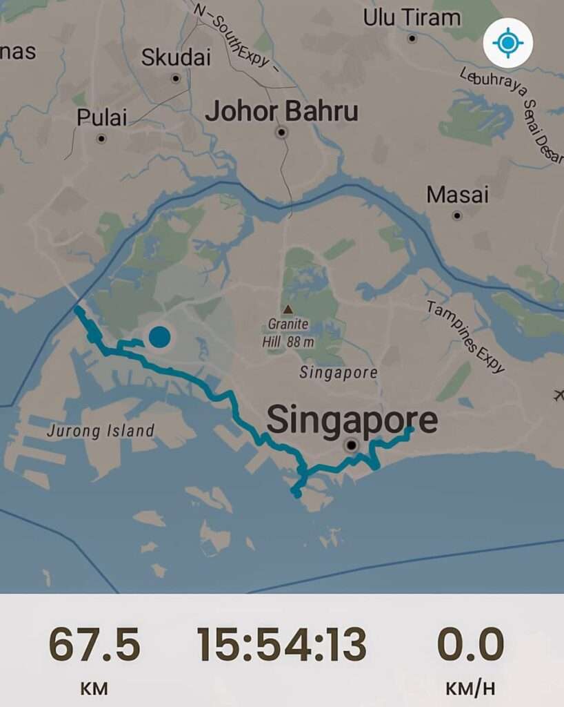
Day 2: Haw Par Villa MRT to Pioneer MRT | 35.7 km, 8 h
Haw Par Villa to West Coast Park
My first morning walking after a long MRT commute.
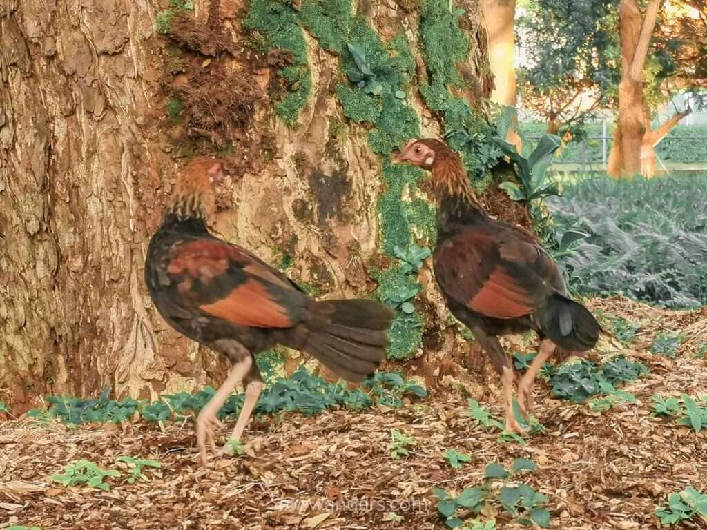
West Coast Park is a strange park sandwiched between the busy West Coast Highway and the towering shipping containers of Pasir Panjang Terminal. Chickens roam freely in the park.
Jalan Buroh & Benoi Sector
One word to describe this section of the route: bad.
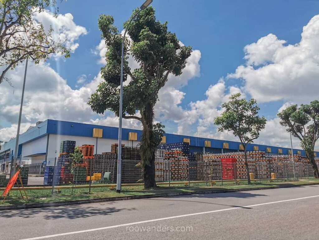
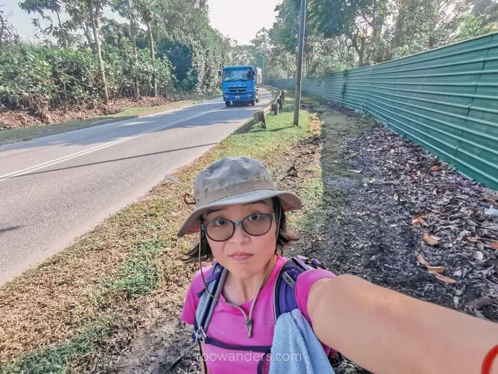
It was awful walking on Jalan Buroh, which connects to Jurong Island and the industrial area. Expect plenty of trucks and freight vehicles going up and down, generating noise and pungent exhaust. I felt my cells crying from the toxic fumes, dust and loud rumbling noise.
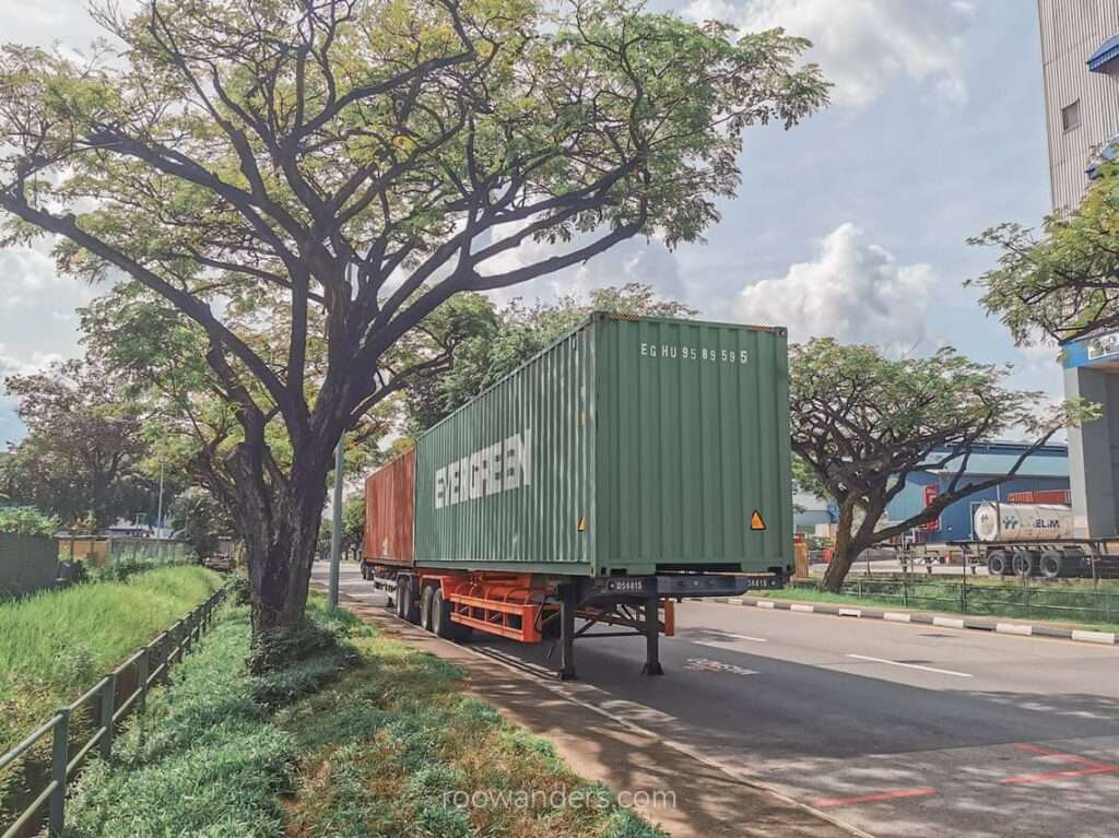

Benoi Sector – an industrial area – towards Gulf Circle MRT was busy with lorries and heavy-weight vehicles. The pavements were badly managed since this area does not expect pedestrian traffic. Expect to walk on the grass by the parked heavy vehicles along Gul Circle.
Tuas Village for Lunch
I stopped by Gul Circle MRT station for a toilet break as the last possible toilet stop would have been West Coast Park.
Instead of following the trail marked by SGTrek, which covers the major road, Pioneer Road, I walked down Tuas Avenue 3 to Tuas Village for lunch.
Lunch was Mee Hoon Kueh ($4) and lime juice ($1.60).
Raffles Marina
From Tuas Village, I continued west towards the marina, passing factories/ offices of familiar brands like Tiger Brewery, Firmenich, JJ Drinks, Meiji, Aalst Chocolate, 3M, Epson, HP Ink Plant and Jacobs Douwe Egberts. What a walk! And then there is the Tuas MRT Depot.
Tiger Brewery does factory tours too, which you can find on Klook.
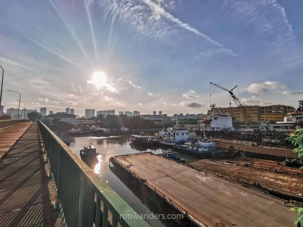
Can you believe it? I walked to the last station on the East-West Line – Tuas Link – when I had never taken the train to this station before. How mad!
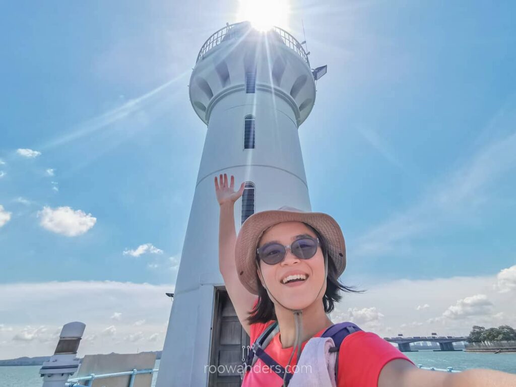
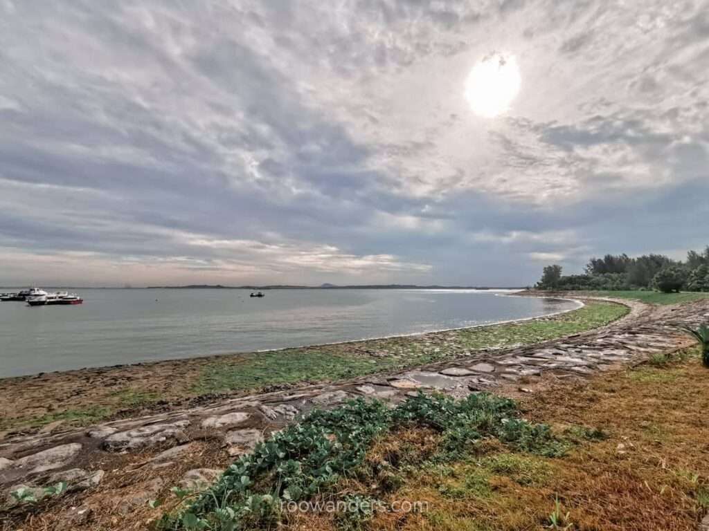
Raffles Marina is adjacent to the MRT station. Walk down the jetty to one of the six operating lighthouses in Singapore overlooking the Tuas Second Link – Singapore’s second causeway to Malaysia. Someone wrote a comprehensive albeit old post on this lighthouse here. The Raffles Marina Lighthouse is known for its beautiful sunset backdrop and is a popular spot for wedding shoots.
Raffles Marina to Pioneer MRT
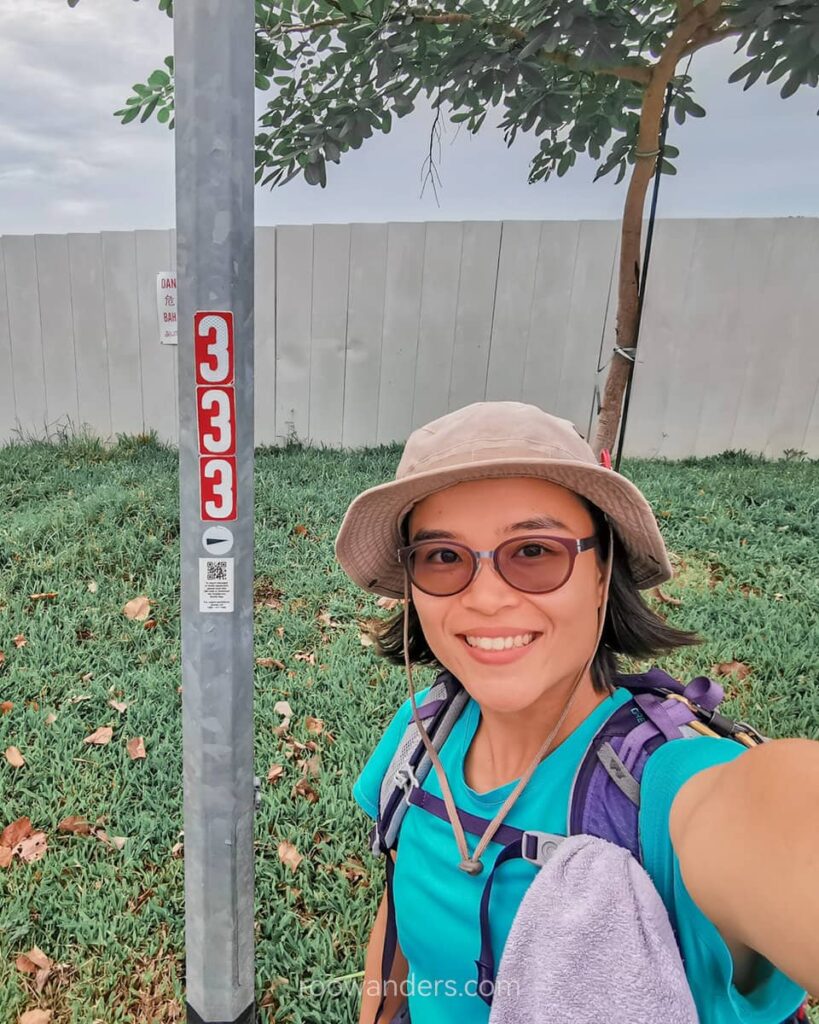
The last 11 km was a test of mental endurance. It was mind-over-body as I crossed the 30 km mark.
I retraced the route back to the Benoi Sector, before deviating north towards the heartlands, passing by SAFTI Military Institute.
Day 3: Pioneer MRT to Marsiling MRT | 24.4 km, 6 h
Pioneer MRT to Lim Chu Kang Road
Another long MRT ride from the East to the far West. Nothing spectacular in the heartlands from the MRT station to the start of the long Lim Chu Kang road.
Lim Chu Kang Road
An unpaved, unsheltered long walk by the six-lane road until Sunnyville Home, where it turned into a narrow two-lane road.
Wear waterproof shoes for this trail if you intend to do it in the morning. Early morning dew and mud soak shoes, like what I have encountered, tend to give rise to more blisters.
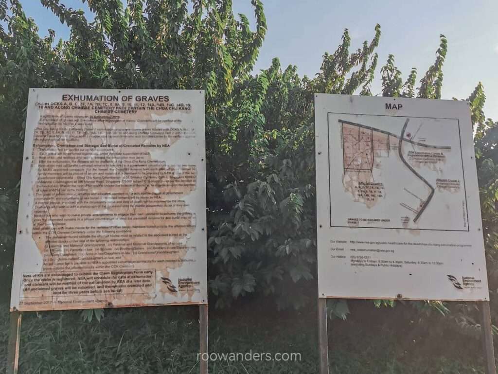
Adjacent to the roads are cemeteries of different religions, though some have or were undergoing exhumation to make way for an existing air base. You can read more about the remaining cemeteries in Singapore in this insightful entry here.
The only respite you could get on this long and hot trail is the old-school bus stops with orange benches and an orange-white striped shelter. One bus plies this route – 975 – for those who want to throw in the towel.
Two-Laned Lim Chu Kang Road
The two-lane route was admittedly tricky to walk as the roadsides were poorly maintained. I had to constantly check for traffic to cross certain bridges or walk some parts of the roads. Heavy vehicles, presumably to farms and contraction sites, hurtle down the narrow roads, making me – the odd solo hiker – precarious in such situations.

To avoid such a predicament, you could do it on the weekends. But I would suggest solo hikers do it on a weekday for another safety concern – the place is too deserted for your good, especially for female hikers. Singapore is safe with severe punishments as deterrence, but you can still get incredulous news like those. Better play safe than be sorry.
Lim Chu Kang
The trail improved as I exited Lim Chu Kang Road to Lim Chu Kang Lanes. There are no pedestrian paths, but at least most of the traffic had left for Neo Tiew Road.
The Lim Chu Kang area is where Singapore’s agricultural farms are. I recalled going to places like the Hay Dairies, Bollywood Veggies, a fish farm, and a crocodile or frog farm on school excursions decades ago. You can read more about it here and book a farm tour to revive nostalgia.
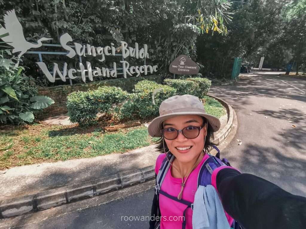
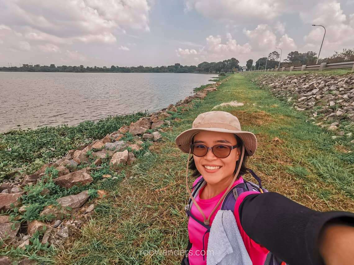
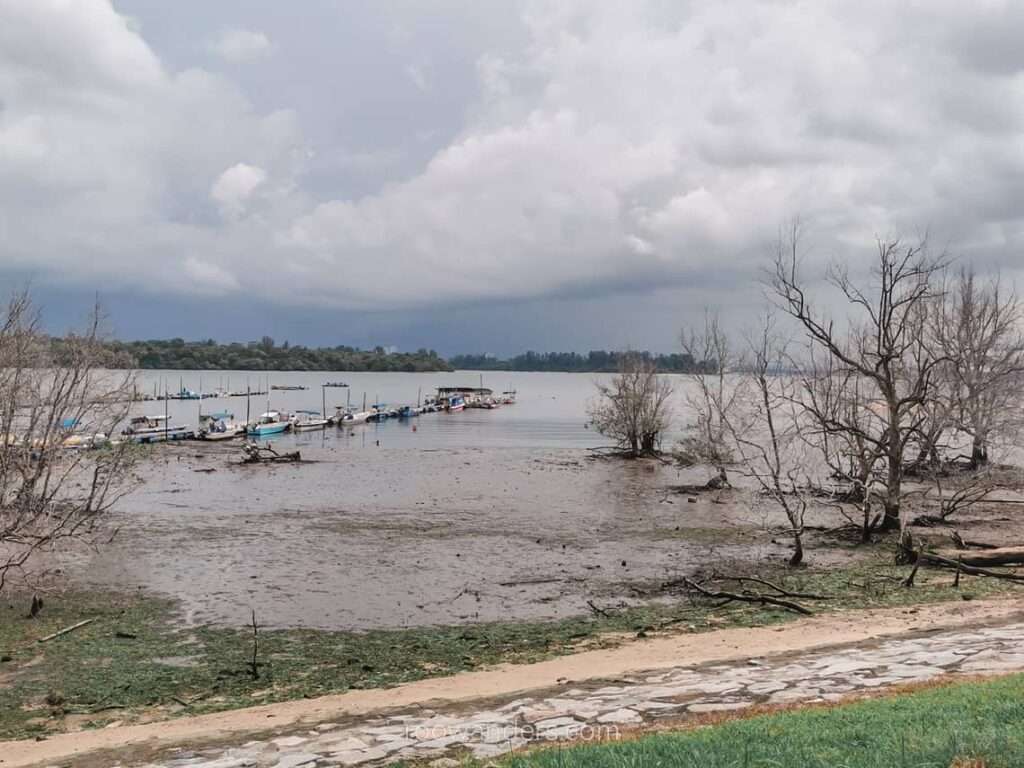
Sungei Buloh Wetland Reserve
Singapore’s first ASEAN Heritage Park features mangroves, mudflats, ponds and forests. Expect low local network connectivity here as your telco switches to Malaysia.
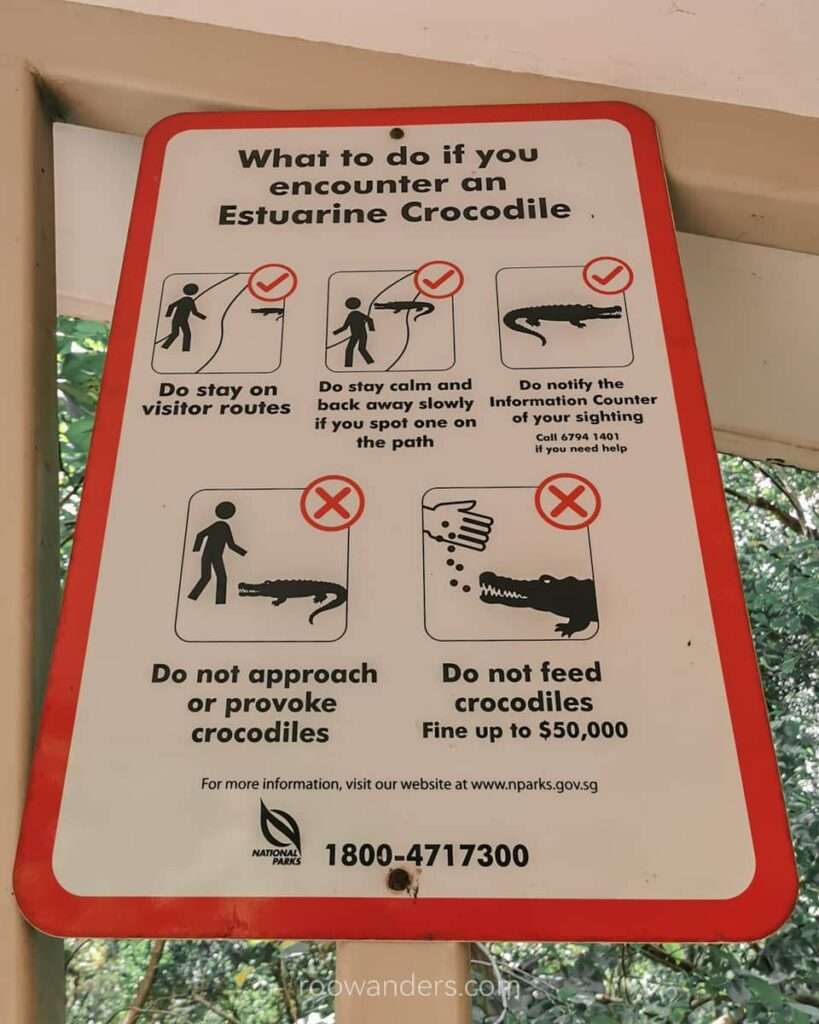
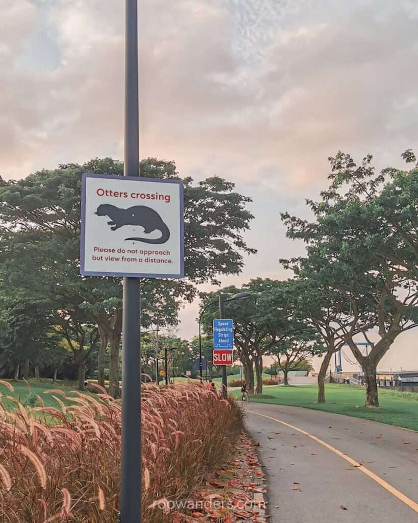
Apart from the giant mudskippers, water monitor and kingfishers, see if you can spot the residential estuarine crocodiles basking around the area.
Kranji to Marsiling
Another long and unsheltered walk in an industrial area from Sungei Buloh Wetland Reserve to Marsiling.
I planned to have lunch at Ji Li Eating House, the closest eatery to Kranji Dam, but the whole place seemed to have been closed for months. All I could do was edit its details on Google Maps.
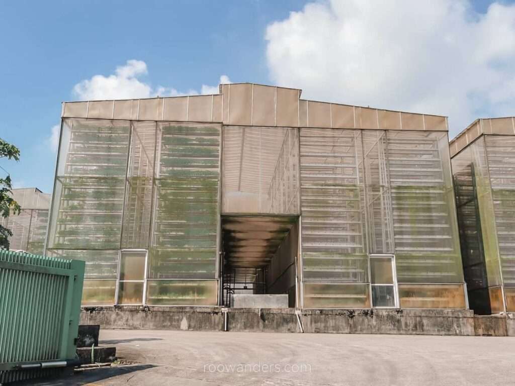
Along the way, I passed the Kranji Water Reclamation/ NEWater Plant and a Wafer Fab Park, which manufactures semiconductors.
A Coffee Shop in Marsiling for Lunch
As you can see, there are simply no food stops on this leg. The only toilet stop/ water refill station is at the Sungei Buloh Wetlands Reserve. Plan your track accordingly.
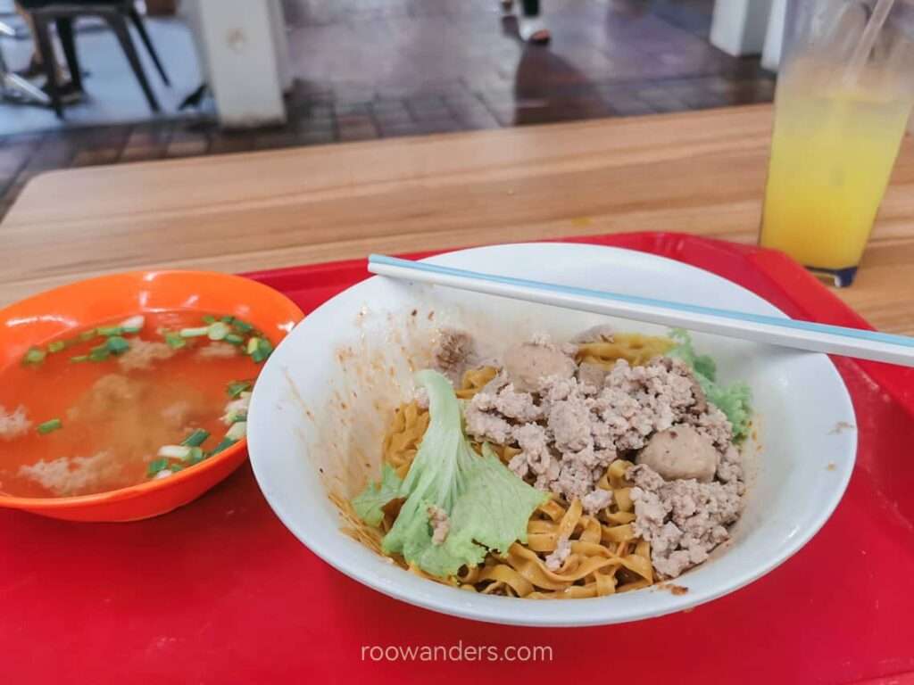
Late lunch was a mediocre Bak Chor Mee ($3.80) and lime juice ($1.70) at a coffee shop opposite the MRT station.
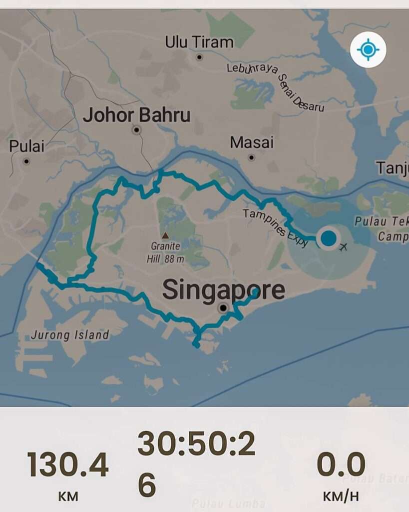
Day 4: Marsiling MRT to Loyang Ave | 38.5 km, 9 h
Marsiling MRT to Woodlands Waterfront Park
Another day of a long commute on the train to start the walk.
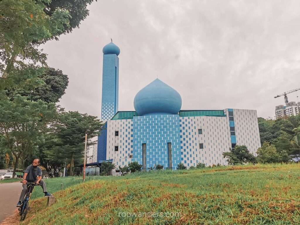
Nothing exceptionally noteworthy in yet another heartland of Singapore, apart from the lovely blue mosque Masjid An-Nur, an unusually high volume of motorcyclists, and traffic to Malaysia across the Woodlands Checkpoint.
Woodlands Jetty
Another gem in the city that I never knew existed if not for this long walk!
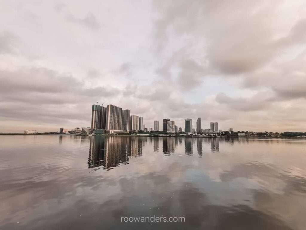
The jetty is also a reminder of how close Singapore is to Malaysia – I could see the flashing advertisement board and cars on the other side of Johor Strait. A ferry takes three hours to cross Cook Strait from South Island to North Island in New Zealand. Sometimes you need three hours to cross the causeway from Singapore to Malaysia too.
The jetty is probably the closest you can get to Malaysia while still in Singapore.
Sembawang Hot Spring
The next stop is about an hour away in the heartlands. There was lots of construction work along Gambas Avenue.
If you have not already known about the hot springs from a brouhaha generated by this Taiwanese Youtuber, then you must be living under a rock in Singapore. Because eww, who cooks chicken wings like this?!
How is there a hot spring in Singapore? And who would soak in a 40 dC hot spring when the air feels like 40 dC too?
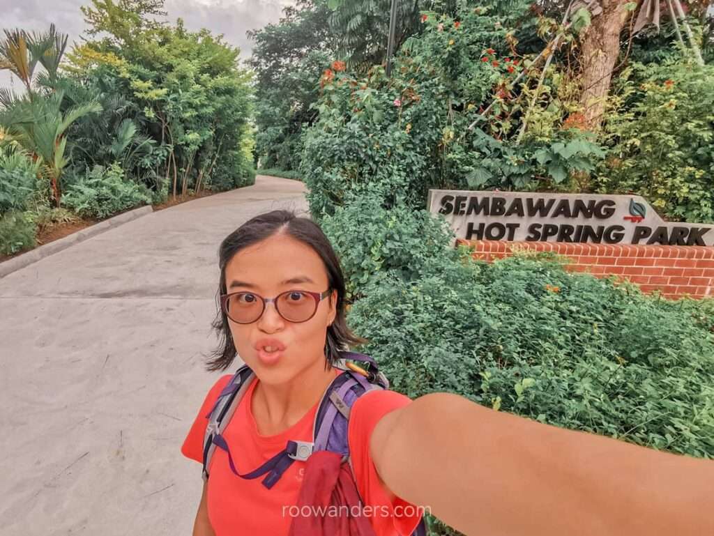
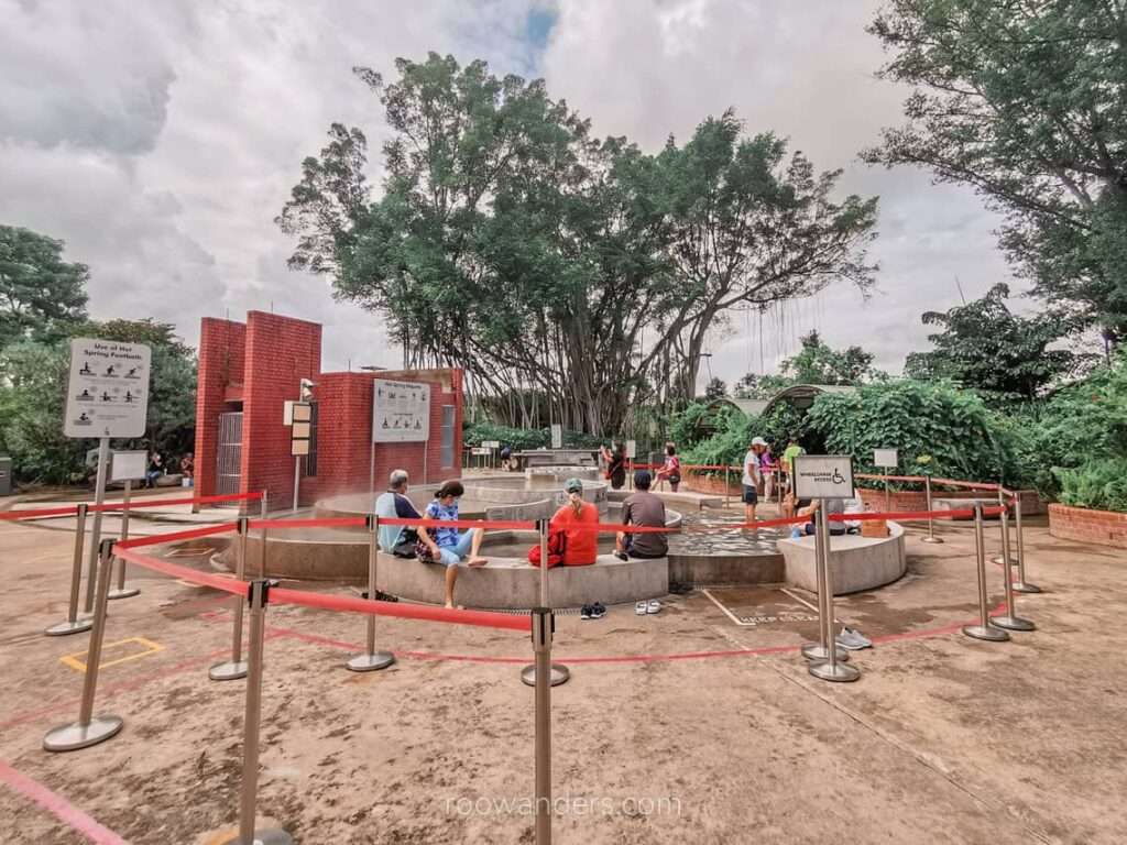
Welcome to Singapore’s one and only accessible hot spring! The other inaccessible one is at Pulau Tekong, which I will never be able to visit unless I have a son (or daughter) serving in the army.
The park had retirees soaking their feet or washing themselves on the weekday morning. Most seemed to have cycled their way there.
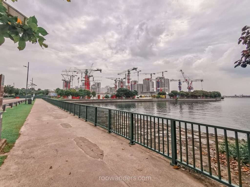
Punggol Islands
I never knew Singapore had that many islands.
The walk from Sembawang Hot Springs to the two islands was long, straight and tedious along Yishun Avenue 8 and the Yishun Dam. The dam may be a nice place to hang out at sunset or on the weekends when there is lesser traffic.
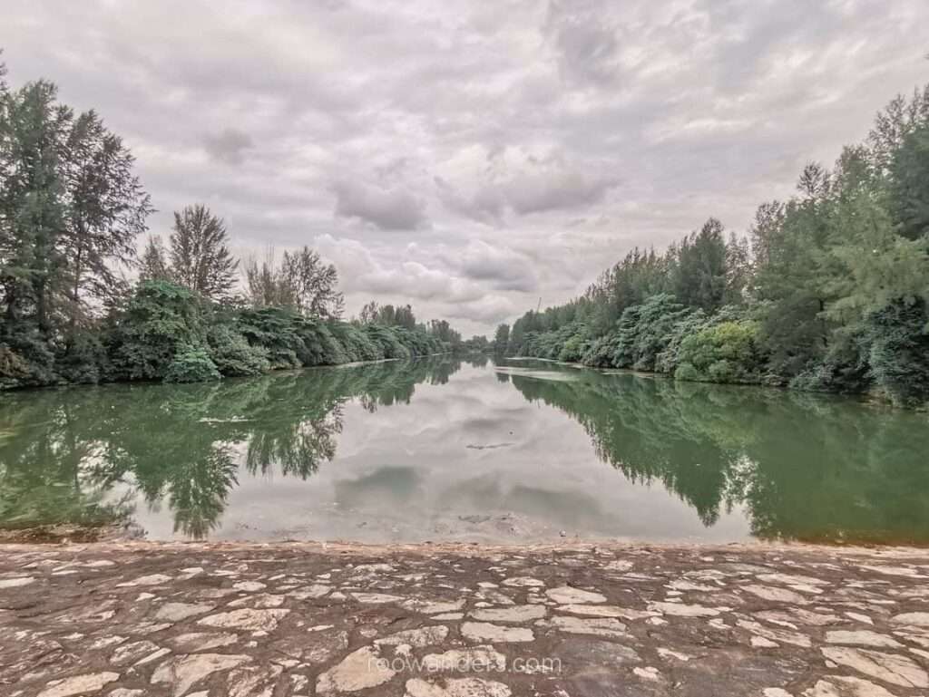
The Punggol Barat and Punggol Timor are artificial islands reclaimed from the sea, mainly used as stockpile sites for granite and sand for construction. These two islands are part of a popular trail amongst leisure cyclists in Punggol. I encountered several groups along my walk.
Kimly Coffee Shop for Lunch
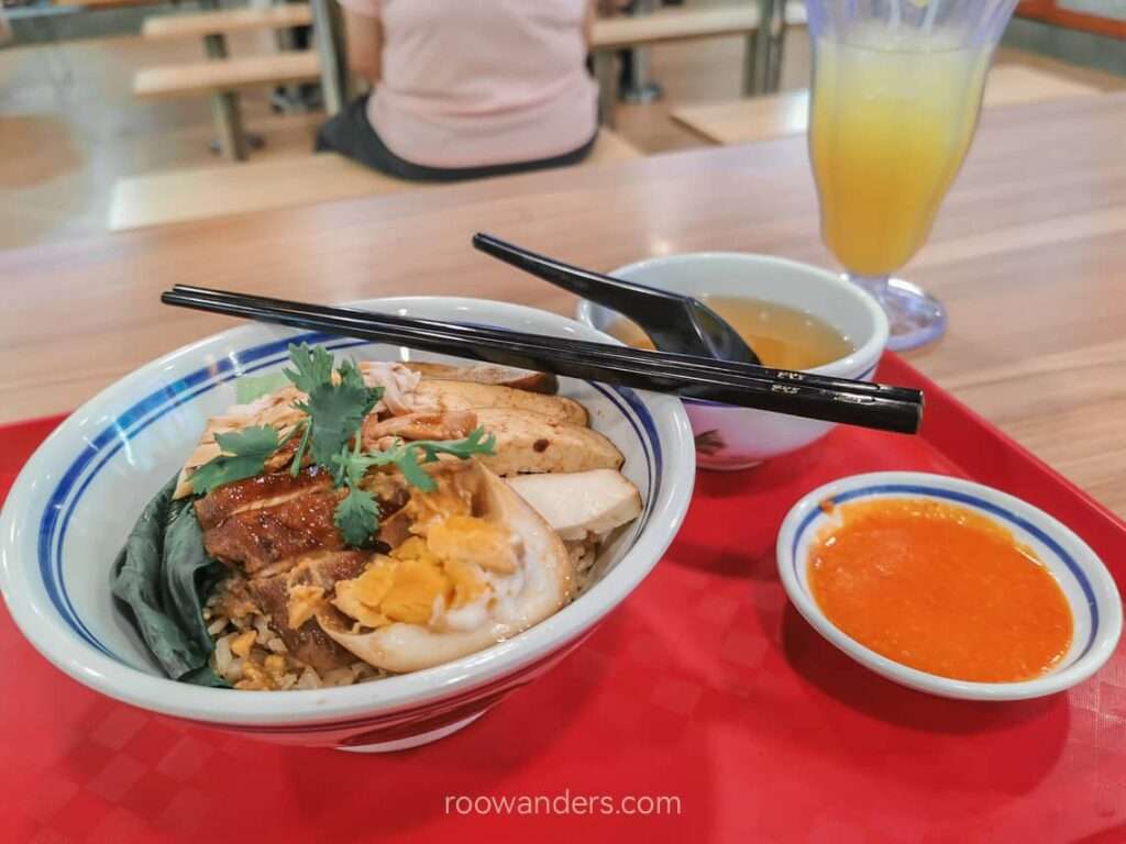
Lunch was the Haikee Towkay Rice bowl ($4.90) and lime juice ($1.60) at this random coffee shop some 5 min walk away from my main route, after the Punggol Tidal Gate.
Coney Island
Park connectors all the way to Coney Island! It was a nice walk on the connector with Johor Strait on one side and the new HDB flats on the other. That was how close the buildings were to the strait and Malaysia.
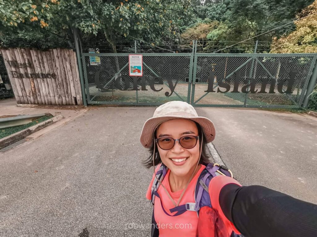
I had the island all to myself. No one was walking in the park as I did on a hot afternoon working day.
Fun fact: Coney Island used to have a lonely wild cow. It was such puzzling news that even the BBC decided to report it.
There was construction on the eastern part of the island, so some routes were inaccessible.
I saw a pair of waterhens and their chick and a wild hog with a handful of piglets. The animals have made a wise decision – I would have chosen Coney Island as my home too if I were them. The park closes from 7 pm to 7 am, and there is no electricity or piped water on the island – that is how rustic and natural the island is.
Pasir Ris to Loyang
The last 10 km was another test of mind-over-body. The walk was, again, in the heartlands. I passed by familiar stops I frequented in my schooling days, like Downtown East Mall. My left calf was in cramps, and I had to tottle to a bus stop along Loyang Avenue for the direct bus home.
Day 5: Loyang Ave to Paya Lebar | 33 km, 7.5 h
Changi Village Hawker Centre
A day of TLC later and I am back for the last stretch!
The route to Changi Village Hawker Centre sees more uniformed personnel than the other avenues I have ventured. An army camp and the Changi Air Base are right around the corner.
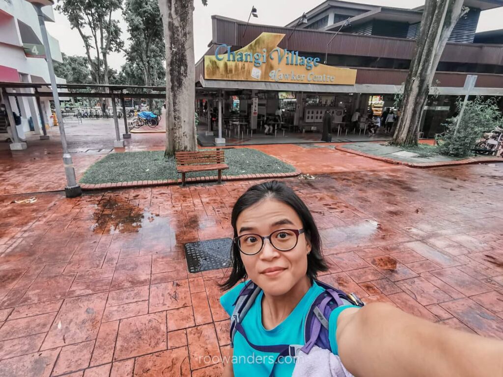
The Changi Village Hawker Centre is a popular pitch stop for cyclists and those waiting to board the ferry to Pulau Ubin at Changi Point Ferry Terminal.
Pulau Ubin is an offshore laid-back island with disused granite quarries, traditional kampongs, and mangrove forests. Of which, Chek Jawa is the most fascinating attraction to visit as you get to look for coastal marine creatures during low tide.
Changi Coast Track and Tanah Merah Coast Road
I am sure any Easterner would have heard of this long track by the airport. Both are part of the completed Eastern Coastal Loop. I have cycled the loop at least twice before this attempt to walk half of it.
Walking by the Changi Coast was pleasant for the tall trees, chirping cicadas and birds, and frequent sea breezes. Walking on a weekday morning meant I had the whole park to myself.
But the same cannot be said for the Tanah Merah Coast Road. There was construction throughout the stretch, blocking the road from the sea. So rather than having welcoming drafts of cool sea breeze, I was bathed in exhaust fumes from trucks rumbling up and down the road.
At the end of Changi Beach Park is the ferry terminal where recruits leave the main island for Pulau Tekong to start their military training. You may read more about the ferry journey on Penguin Tekong in this satirical post.
More uniformed personnel appeared towards the end of the long road, this time in whitish-speckled attire, as this is where the Changi Naval Base is.
Walking down the Tanah Merah Coast Road is almost like walking up the Lim Chu Kang Road – they are about the same distance! The main difference being Tanah Merah Coast Road has trees, proper shelter stops, numbered lamp posts for you to do the countdown, and an impeccably manicured connector. It was grass and mud, old cemeteries, and old and dusty bus stops as shelters for the latter.
East Coast Park
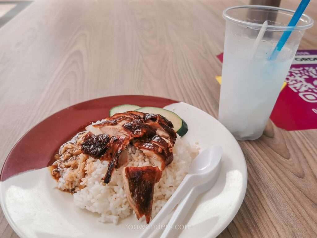
East Coast Park held many fond memories for me. It was where I jogged or cycled almost every weekend and was a place to cycle/hang out with friends during the school holidays. We would cycle to the lagoon food village for meals, incidentally where I had for my lunch that day – duck rice for $5 and coconut drink for $1.60.
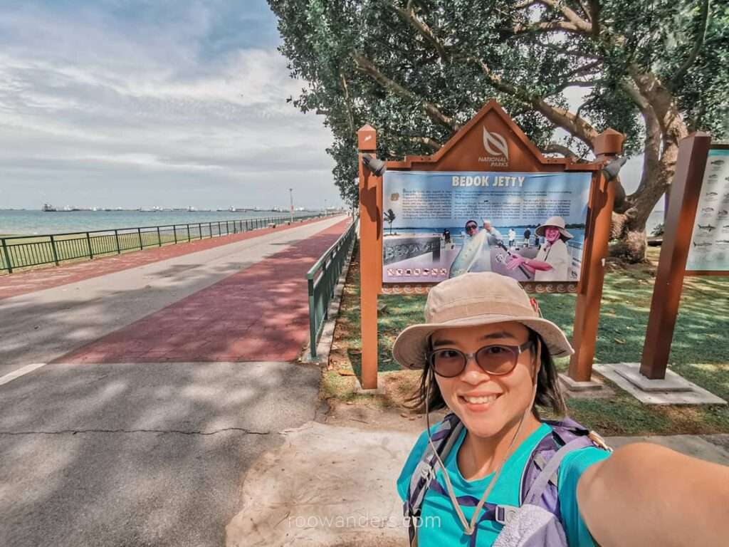
The Bedok Jetty was not that busy in the afternoon with anglers. The jetty is the most popular shallow and deep-water fishing spot in Singapore.
East Coast Park to Paya Lebar
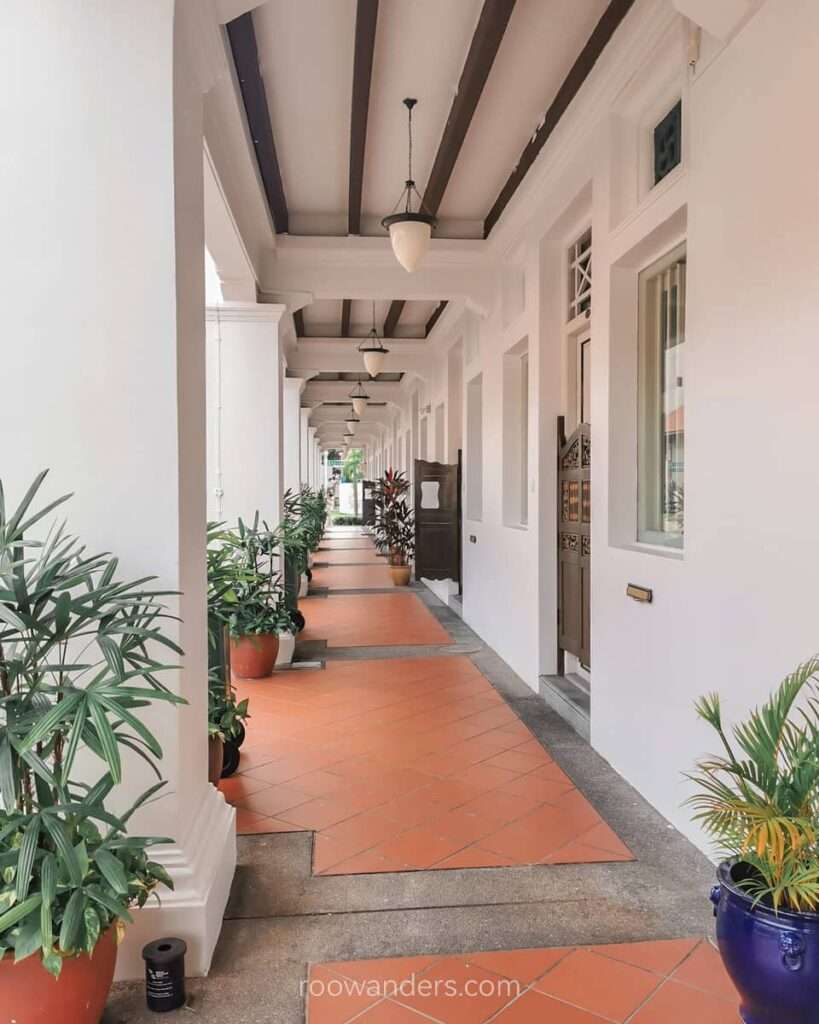
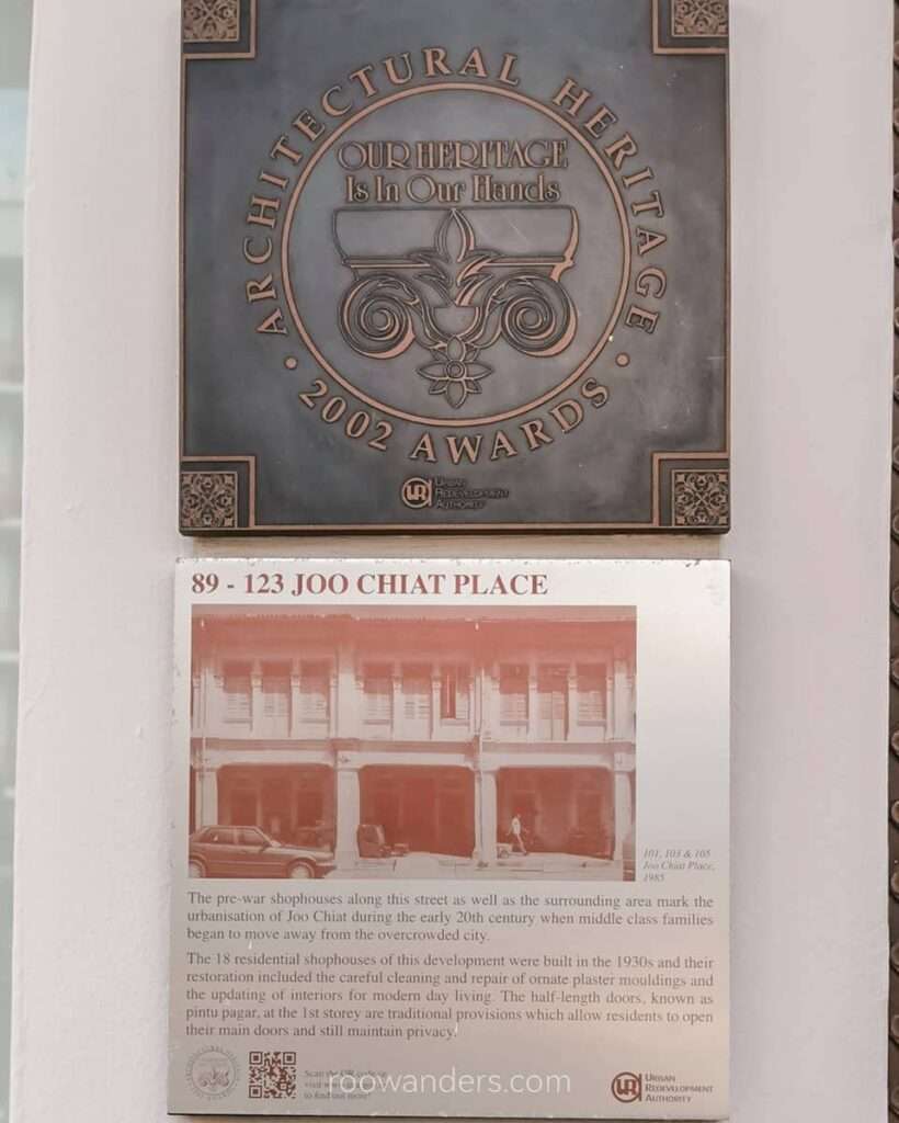
Post lunch, I walked down the small avenues of Singapore’s first Heritage Town and Peranakan enclave – Katong and Joo Chiat – to Singapore’s oldest Malay settlement – Geylang Serai – and finally home.
Interested to learn more about Joo Chiat? There’s a tour for it here.
Overview
The long walk was a great way of acquainting with Singapore again. If not for the walk, I would never have ventured into the Far West and visited the Raffles Marina Lighthouse. Neither would I even think of walking the Lim Chu Kang stretch myself. It was also my first time visiting the Woodlands Jetty overlooking the Johor Straits, despite living in this country for N years and crossing the causeway almost every month in the pre-pandemic days to hike.
Figures
The five days led me to different parts of Singapore:
Day 1 showed me the financial and touristic centre of the island;
Day 2 brought me to the dusty and chaotic industrial sector;
Day 3 led me into a remote corner of Singapore;
Day 4 was in the heartlands; and
Day 5 was along Singapore’s favourite beaches, parks and trails.
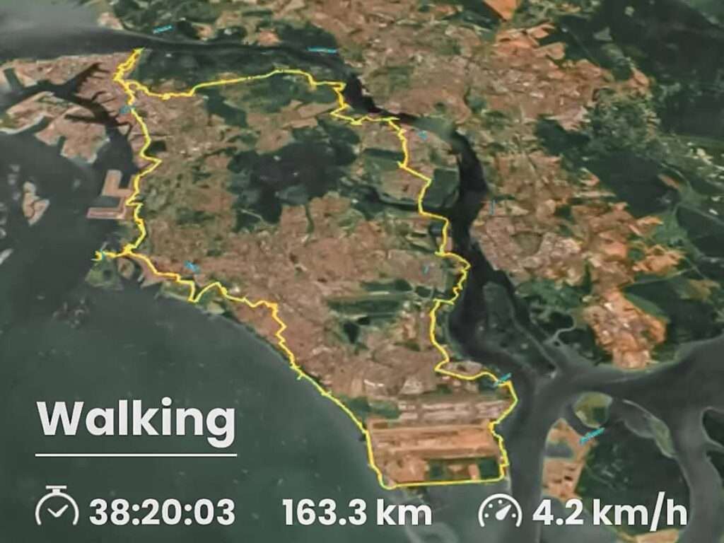
Here are the stats!
- 160 km (163 km to be exact)
- 38 hours of walking
- 246 600 steps
- 4100 kcal or 55 eggs
Damages: cramps, blisters, heat rash
Would I do this again?
A resounding NO.
Once in a lifetime is enough for me, just like bungy jumping in Queenstown. But I would recommend this to anyone – treat it like a pilgrimage or a test of mental endurance. It was mind-over-body for me as my legs started to hurt from the cumulative stress of hours of pounding.
Learnings
I learnt to calm down my monkey mind during the long walks and was more observant of little details along the way – like noticing a tiny waterhen chick in Coney Island, an abandoned sunbird’s nest around Changi Beach Point, and fallen honeycombs along Lim Chu Kang Road. Also celebrating the little milestones met during the walks. Lunch was exceptionally delicious, and the temporary respite while waiting to cross the road was a good time for some much-needed quick stretches.
Having travelled to so many places, the scenery in Singapore pales in comparison to nature walks in other countries. But the long walk is not too bad, considering the size of the country and city-state. We still get many trees and greenery along the way, compared to most cities I have been to.
Safety
This long walk was generally safe for me, a solo female. I chose to do my walks on working weekdays, especially in remote areas like the Far West. Sharing the roads of Lim Chu Kang with heavy vehicles was a bit tricky and dangerous. Doing the walks on the weekends would be ideal since there would be lesser traffic and exhaust fumes. Grab a partner or two to share the common experience.


You May Also Like
Great Walk Series: Milford Return Track | Fiordland
Hiking Mulu Pinnacles: The Most Challenging 2.4 km